

NEWS
Knopf Presents Project Findings at the Minnesota GIS/LIS Conference
In mid-October, Jeff Knopf presented at Minnesota’s GIS/LIS Conference in Bemidji. Jeff spoke about his involvement in a pilot project with the State of Minnesota’s 3D Geomatics DEM Hydro-modification Subgroup to investigate the value of legacy breachlines and newly acquired high resolution digital elevation model (DEM) data for usefulness in hydro-modification. Considerable money has been spent on the creation of the legacy breachlines and, with the acquisition of new DEMs for the State of Minnesota, many stakeholders are concerned as to whether money spent on breachlines required for hydro-modification was lost. Hydro-modification is a necessary step to prepare elevation models for analysis, such as, identification of where to place best management practices, flood analysis, measurement of nitrogen and phosphorus transport, to name a few. The pilot project found that the legacy breachlines are an essential dataset for hydrologic modeling and terrain analysis.


GSS in Final Stages of New Mexico Wetland Mapping Projects

Areas with a green outline were completed in September; areas outlined in blue are next to be finalized.
GeoSpatial Services has been working with the New Mexico Environment Department (NMED) for over a decade to map the state’s wetlands and assess wetland functions. At the end of September, GSS completed and submitted three more study areas, leaving only three study areas to finalize in the state. As the project wraps up, GSS is working with NMED to create an online story map that will share what we’ve learned with the public. The website will describe the importance of wetlands, the types found in Mexico, and the valuable functions they perform, such as groundwater recharge, surface water detention, and wildlife habitat provision. In September, GSS Director Andy Robertson travelled to New Mexico to collect photos for use in the story map. He criss-crossed the state, visiting the Apache and Cibola National Forests, the San Juan River and Rio Grande, and the mountains surrounding Santa Fe. The Valles Caldera National Preserve in north central New Mexico was a particular highlight, thanks to recent rainfall, late-blooming wildflowers, and elk.


BLM Alaska Fieldwork - Summer 2022 Edition
This summer saw a continuation of the ongoing work GeoSpatial Services (GSS) is doing in Alaska for the Bureau of Land Management (BLM). GSS has had wetland mapping contracts with the BLM for 4 years now. Each of its awarded contracts includes a field component for verifying its computer-based GIS work. Fieldwork is done on each project to compare the wetland data created in the office to actual landscapes, and not solely relying on the satellite imagery used in the work.
This summer’s BLM work was similar to past years in that a team was sent to Alaska to complete data collection and data comparisons utilizing helicopters, cameras, soil and vegetation sampling, and more. This year’s team was led by Eric Lindquist and James Loken, who spent 20 days in the vast landscapes of Alaska. The pair traveled many miles by car, plane and helicopter. Lindquist and Loken traveled from Fairbanks, AK to remote villages/towns such as Bettles, Galena, Nome and more. Areas of unique interest included the Seward Peninsula and the Bering Land Bridge, Kobuk/Noatak National Park, Kobuk Sand Dunes, and more. This work will continue for nearly two more years and will employ numerous staff and students!


Robertson presents at Tribal Conference
During the last week of August, GSS Director Andy Robertson attended and presented at the National Tribal and Indigenous Climate Conference (NTICC) in St. Paul. This biennial conference convenes “knowledge holders on climate change and resilience efforts with an emphasis on the intersection, inclusion and honoring of Traditional and Indigenous Knowledges”. Robertson’s presentation was titled “Working with Tribal Communities to Build Wetland Program Capacity and Advance Tribal Wetland and Water Quality Assessment Programs”. It covered an ongoing collaboration between GSS and the Mandan, Hidatsa, and Arikara Nation (also known as the Three Affiliated Tribes, or TAT) of the Fort Berthold Reservation in North Dakota. GSS has been working with TAT to update wetland mapping for the reservation (see map below), identify potentially restorable wetlands, conduct a wetland functional assessment, and complete a wetland program plan. In addition to TAT, GSS has also worked on wetland projects with the Stockbridge-Munsee Band, the Shakopee Mdewakanton Sioux Community, and the White Mountain Apache.

GSS is currently partnering with the National Association of Wetland Managers (NAWM) on two EPA grants to provide training for tribal community staff on wetland programs and Clean Water Act programs. Over the next 6 years, NAWM and GSS will be offering webinars and in-person workshops, as well as developing web-based resources, to help build tribal program capacity.
Returning to the West
In August, staff members Eric Lindquist, Matt Hogan, and Klaus Friedli completed draft map review fieldwork for the most recent Wyoming NWI update project. The trip lasted 10 days, conducting field verification and collecting photos in the project area. The trip brought us to interesting towns such as Ten Sleep, Cody, Lander, and Dubois. Klaus’s botany and plant identification skills made it easier to identify wetland indicator species during a particularly dry season. The project area encompasses multiple ecoregions including some of the following: Rolling Sagebrush Steppe, Black Hills Plateau, Granitic Subalpine Zone, Mid-Elevation Forest and Scrublands, and Powder River Basin. The field crew was able to collect data on the fly using data collection iOS applications from ESRI along with a Toughbook displaying multiple collateral datasets. The team has solidified their knowledge of wetland mapping in Wyoming after completing this third round of fieldwork in the state over the last several years. This project is set to be completed and delivered in 2023.


Tribal Collaboration Continues
In mid-August, five GSS staff members and one student travelled to the Leech Lake Reservation in north-central Minnesota to collect lake sediment cores for a phosphorus flux analysis. Kevin Stark, Eric Lindquist, Kathy Allen, Randy Krainock, Mary Larson, and Katrina Danzinger, along with Jake Sorensen from the Leech Lake Band of Ojibwe (LLBO), sampled water quality and collected seven cores each from Bowstring and Round Lakes. The sediment cores will now be incubated in a lab on campus and sampled regularly to determine how much phosphorus is being released by the sediment. This will help determine whether nutrients stored in the lake sediment may be contributing to high phosphorus levels (internal loading) or whether elevated phosphorus levels are due to outside sources, such as fertilizers and septic systems (external loading). Elevated phosphorus levels can trigger excess algal growth and cause declines in dissolved oxygen, which can kill fish and other aquatic life.


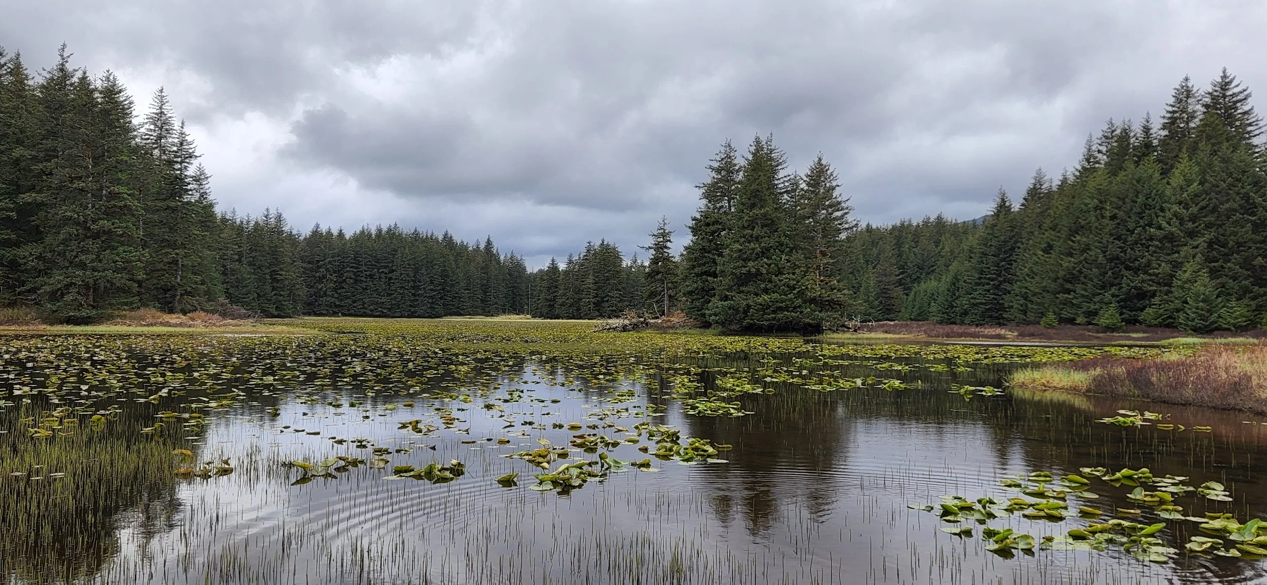
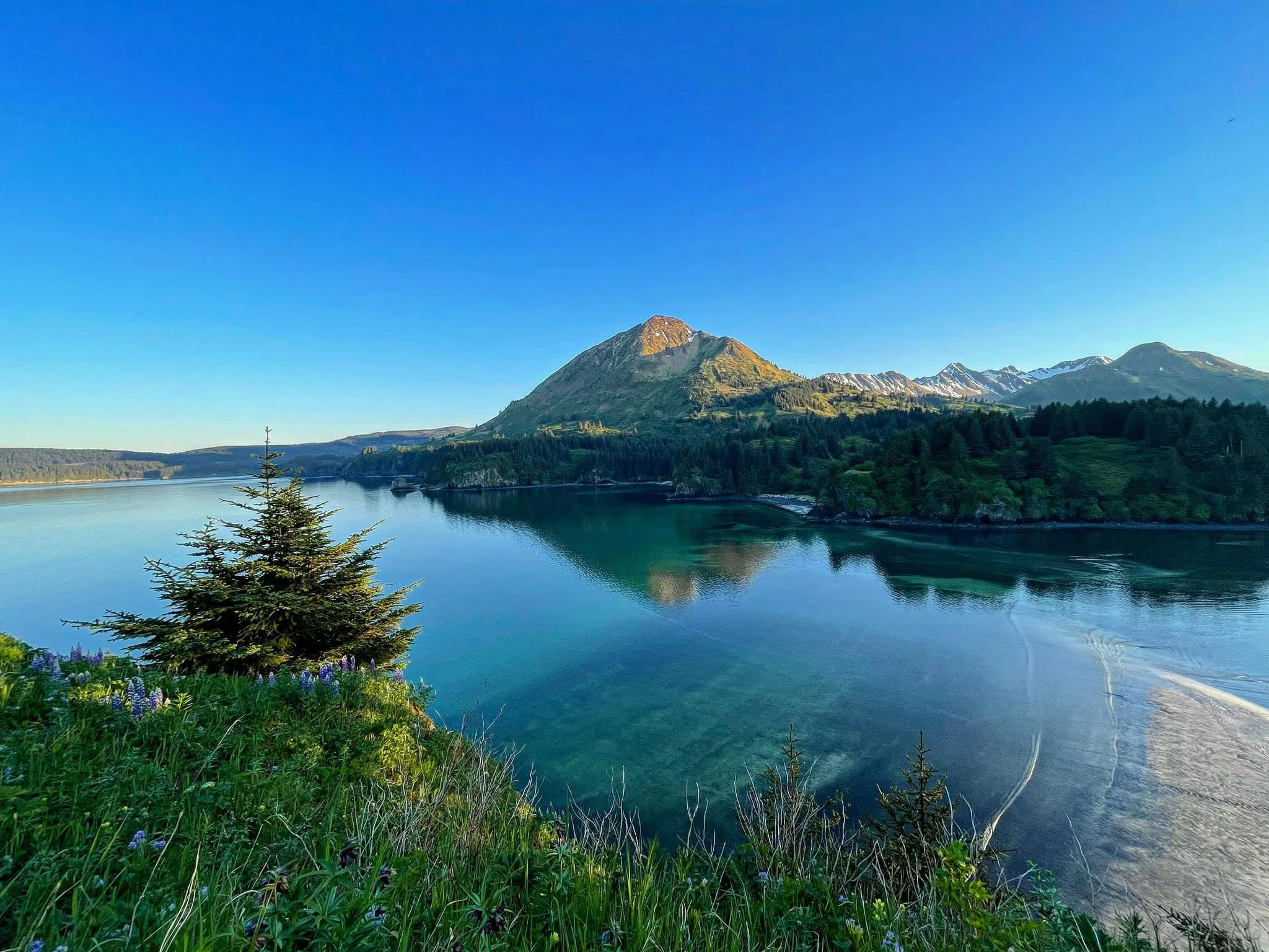
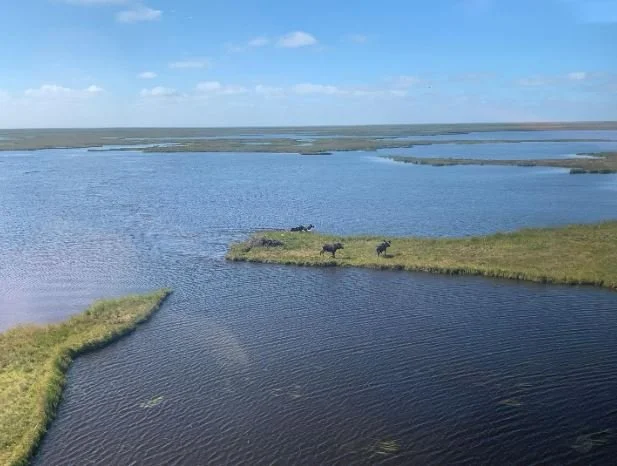
Alaska Coastal Expedition
In late May, GSS staff members Andy Robertson, Kevin Stark, and Eric Lindquist travelled to the Alaska Peninsula to conduct fieldwork along Shelikof Strait and the Kodiak Archipelago. This trip was part of a larger project to map hydrography and wetlands along the southern coast of Alaska for the U.S. Fish and Wildlife Service and U.S. Geological Survey. This particular project falls within the area affected by the Exxon Valdez oil spill (EVOS), the impacts of which are still being studied. Due to the rugged and inaccessible nature of the Alaska coast, the majority of work had to be conducted by boat or helicopter. A “support boat” travelled along the Alaska Peninsula and served as a moving base of operations, providing the field crew with lodging, food, and helicopter fuel. The crew also spent several days surveying wetlands around the town of Kodiak by car, when low clouds made flying impossible.


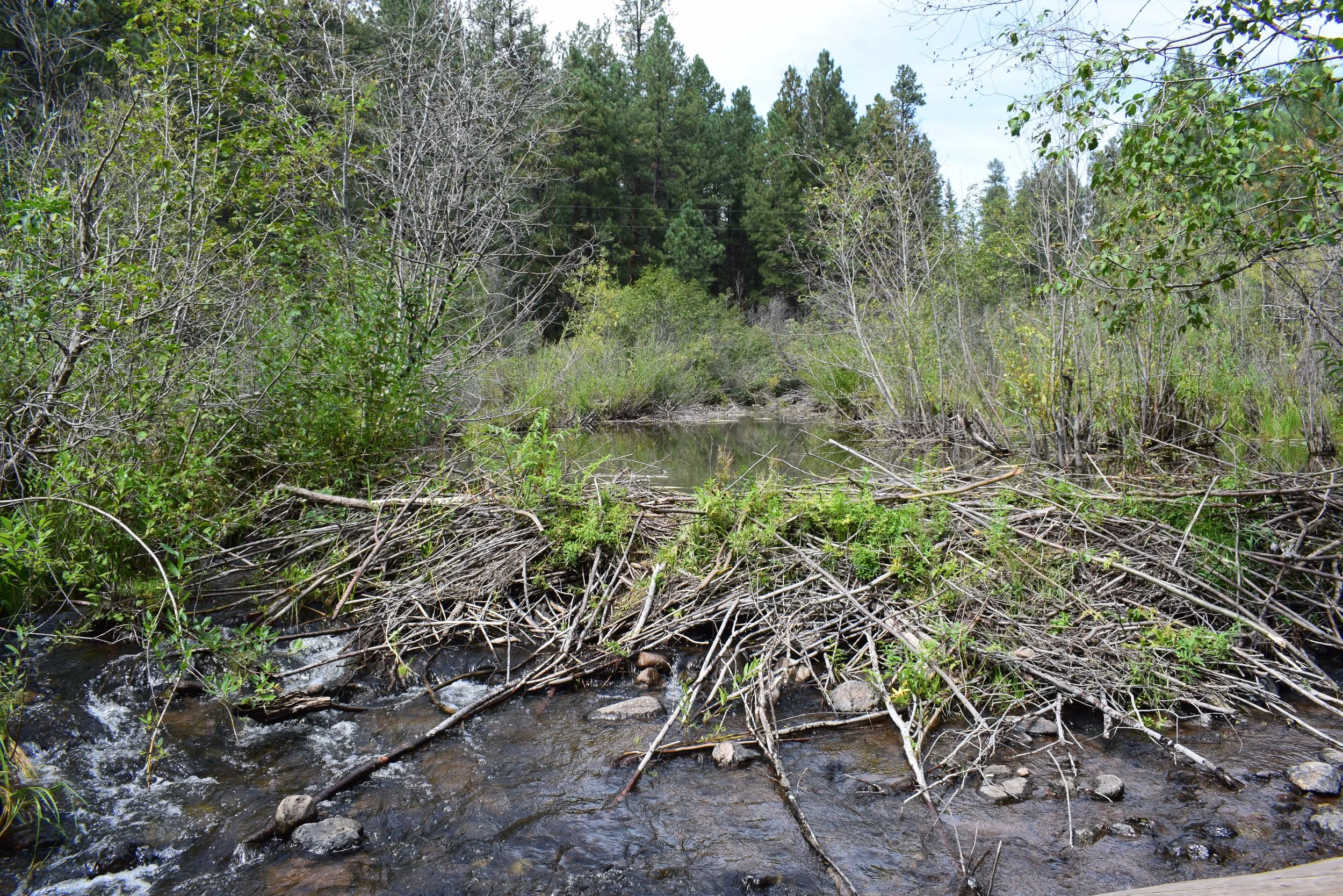
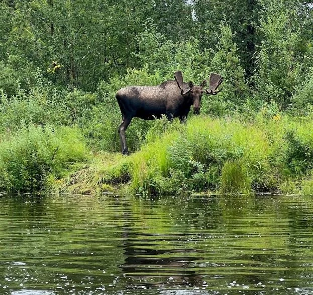
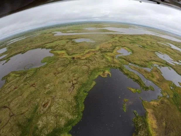
Adventures on the Yukon and Andreafksy Rivers
For the first two weeks of August, GSS staff members Katie Engelmann, Michael Knudson, Emma Behling, and Klaus Friedli conducted two types of wetland identification field work based out of Saint Mary’s, Alaska, a remote village west of Anchorage. The field crew aimed to refine preliminary wetland mapping and identify conventions for the interpretation of the wide variety of wetlands in the area, and verify satellite imagery in relation to actual landscape ecology.
Engelmann and Behling were joined by the regional coordinator for the U.S. Fish & Wildlife Service, Sydney Thielke, and primarily collected data through helicopter flight and roadside surveillance. Knudson and Friedli were joined by four staff from the Yukon Delta National Wildlife Refuge, including the Refuge Manager Boyd Blihovde, and divided into two raft crews to float the North and East forks of the Andreafsky River and collect data through riverside hikes.
The Yukon River is almost 2,000 miles long, and by helicopter one field crew was able to visit its discharge into the Bering Sea. The team measured salinity and tidal influence in a wide band of wetlands at the coastline and further inland to determine the extent of tidal influence and saltwater on wetland ecology. The helicopter crew was also able to visit several mud volcanoes in the project area, investigate the impact of recent wildfires on wetland ecology, and gain a better understanding of broader landscape shifts as permafrost thaws and basins fill with water or drain and become vegetated.
The float crews tried their best to stay dry, and keep track of the countless wildlife they saw up close. By raft, the crews gained a unique insight into a remote and incredibly protected area that makes up a large portion of the study area. Their experiences and observations were invaluable in refining mapping conventions and understanding the movement of water across the landscape.


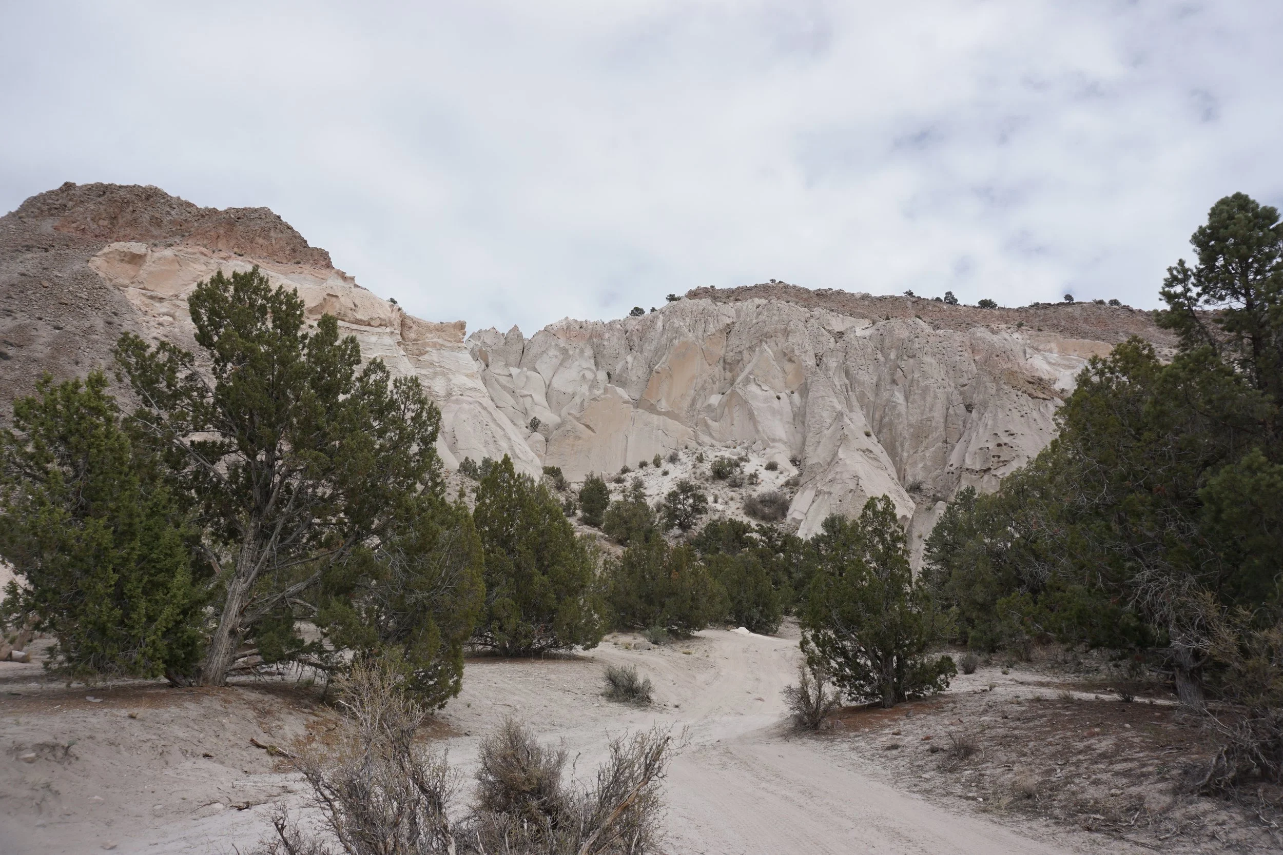
Finding Wetlands in the Arid West
In early April, at the beginning of the GSS fieldwork season, GSS staff members Andy Robertson, Zachary Ansell, and Josh Balsiger conducted pre-mapping fieldwork for a Bureau of Land Management Project in Southeast Nevada, just outside Las Vegas. The purpose of the trip was to identify conventions for the interpretation of wetland matrices in the study area. GSS staff spent 8 days in Nevada, covering 2,156 miles, and collected data at 111 different pre-selected and ad-hoc checksites.
The arid west has unique hydrology that is characterized by localized precipitation events that play a big role in the hydrogeomorphology of the region. Features that GSS was able to develop wetland mapping conventions for included mineral flats, mountain springs, USFWS refuges, and high mountain drainage divides. Soil samples provided an important look into the hydric nature of soils at varying check sites and were especially interesting in high altitude depressions where water ponds when ephemeral flow paths upstream experience precipitation events.
The trip brought the team from the basins of prehistoric lakes to groundwater expressing springs gushing out of mountain sides, along with an occasional disappearing stream. It served to distinguish unique image signatures, identify water regimes and helped inform an understanding of the wetlands present in the study area.


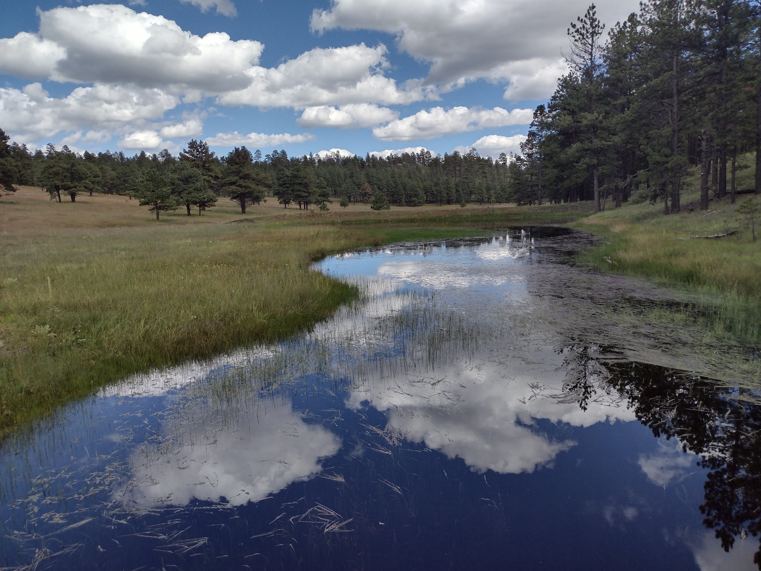
Northern Great Plains Field Work
In early June, GSS staff members Nick Lemcke, Jeff Knopf, and Darren Omoth conducted fieldwork in north central North Dakota for an upcoming wetland mapping project designed with the purpose of creating a detailed wetland inventory to provide understanding of habitat conditions and management options for our U.S. Fish and Wildlife Service partners. The fieldwork covered the counties of Renville, Bottineau, Rolette, McHenry and Pierce. Field notes and pictures were acquired in order to document the landscape, vegetation, soil and hydrology at check site locations to establish a guide for identifying and classifying wetlands.
The highlights were time spent in the Upper Souris and J. Clark Salyer National Wildlife Refuges, primarily river valley wetland habitats which provide sanctuary for waterfowl and migratory birds. The trip also brought the team into North Dakota’s Turtle Mountains. These forested glacial-formed mountains are covered with hundreds of lakes and ponds. A perfect representation is the Wakopa Wildlife Management Area, which is found on the eastern side of the Turtle Mountains. Although only 700–800 feet above the plains, they are truly mountainous against the flat topography of the surrounding landscape.


