

NEWS
GSS Spotlight!
ROSE KRAUS
STUDENT TECHNICIAN
What is your education and/or professional background?

I am a senior Environmental Biology major at Saint Mary's University and I have been working at GSS for almost two years.
What led you to GIS? More specifically, how did you get to Saint Mary's University of Minnesota (SMUMN) in Winona?
I was led to Saint Marys after being recruited here to play hockey. After I looked into the Environmental Biology program, I knew it would be perfect for me. Before GSS, I worked at the SMU Help Desk. While there, I heard a little bit about GeoSpatial Services but I really didn’t have a clue what GIS was or what the job entailed. After talking to some of my E. Bio classmates who worked with GIS, I knew that I needed to apply because it would be a great opportunity for me.
Explain briefly a project at GSS you've done that contributed to your overall knowledge and educational experience.
Since starting at GSS, I have worked on many projects including mapping wetlands in Idaho, Utah, and Wyoming. When school got shut down due to COVID, I got to work full time from home during the summer of 2020. While working at home, I had the opportunity to work at Cascade Meadow with other GSS staff to help with invasive species control, water sampling, and macroinvertebrate research. All of the work that I have done at GSS has positively affected my education experience at Saint Mary’s and I will use it for the rest of my life.
How do you see GIS fitting into your future?
I definitely see myself using GIS in my future career. It is such a growing field and many jobs I have applied to have it as a required/desired skill. Because of this, having GIS experience on my resume will help me stand out from other candidates, especially in the environmental field.
Where can we find you outside of GSS?
Outside of GSS, you can almost always find me at the hockey rink or in the library. When I am not playing hockey or studying, I like rollerblading around Lake Winona or hiking the bluff trails.
GSS Spotlight!
ALEX VASLOW
Graduate Student Technician

What is your education and/or professional background?
I have a B.S. in environmental geology from Winona State University and am currently in my second year of the M.S. in Data Intelligence and GeoAnalytics program here at SMUMN.
What led you to GIS? More specifically, how did you get to Saint Mary's University of Minnesota (SMUMN) in Winona?
I took an intro to GIS course as an undergrad and immediately loved working with the program. At the time I wasn’t sure what I was going to do afterwards, but I knew that I wanted to go beyond a bachelor’s degree. My professor, Dr. Dylan Blumentritt, greatly encouraged his students to explore GIS as he showed us how useful it can be with real-world applications. I asked if there were any programs he recommended specifically for GIS and he pointed me in the direction of Saint Mary’s. He even got an SMU student to come give a brief presentation to the class about the programs!
Explain briefly a project at GSS you've done that contributed to your overall knowledge and educational experience.
Since I’ve started I have been working on the National Wetlands Inventory for North Dakota. This is a project that was started by the U.S. Fish and Wildlife Service to provide detailed wetlands information in many states in the U.S. for both public and private use. What I do specifically is identify and map out detailed wetland polygons in the region.
How do you see GIS fitting into your future?
I plan on using GIS for the rest of my career. I am getting married soon and because of that I plan to get any position that supports us enough. However, eventually I would like to land a GIS director position.
Where can we find you outside of GSS?
Outside of GSS I spend a lot of time with my friends playing board games, tennis, racquetball, and walking around the lakes. I also love playing magic at Jimmy Jams in downtown Winona.
GSS Winona Staff All Under One Roof
After years of being divided between the Prairie Island Field Station and various locations around campus (most recently in Watters Hall), the Winona staff of GeoSpatial Services is now all in one location in the Saint Mary's Press Building. This location provides enough space for the nearly 30 full-time analysts and technicians, along with approximately 40 student workers.
"Our new location provides us with a professional, collaborative space that will increase the productivity and visibility of our organization,” says GSS Executive Director Andy Robertson. “Being centrally located on campus will make it much easier for our student technicians to access the building during work hours and will allow us to contribute to other University activities such as tours, meetings and planning sessions. Our thanks to SMP staff for making us welcome in their space and helping facilitate a smooth transition."

GSS Team Criss-Crosses New Mexico
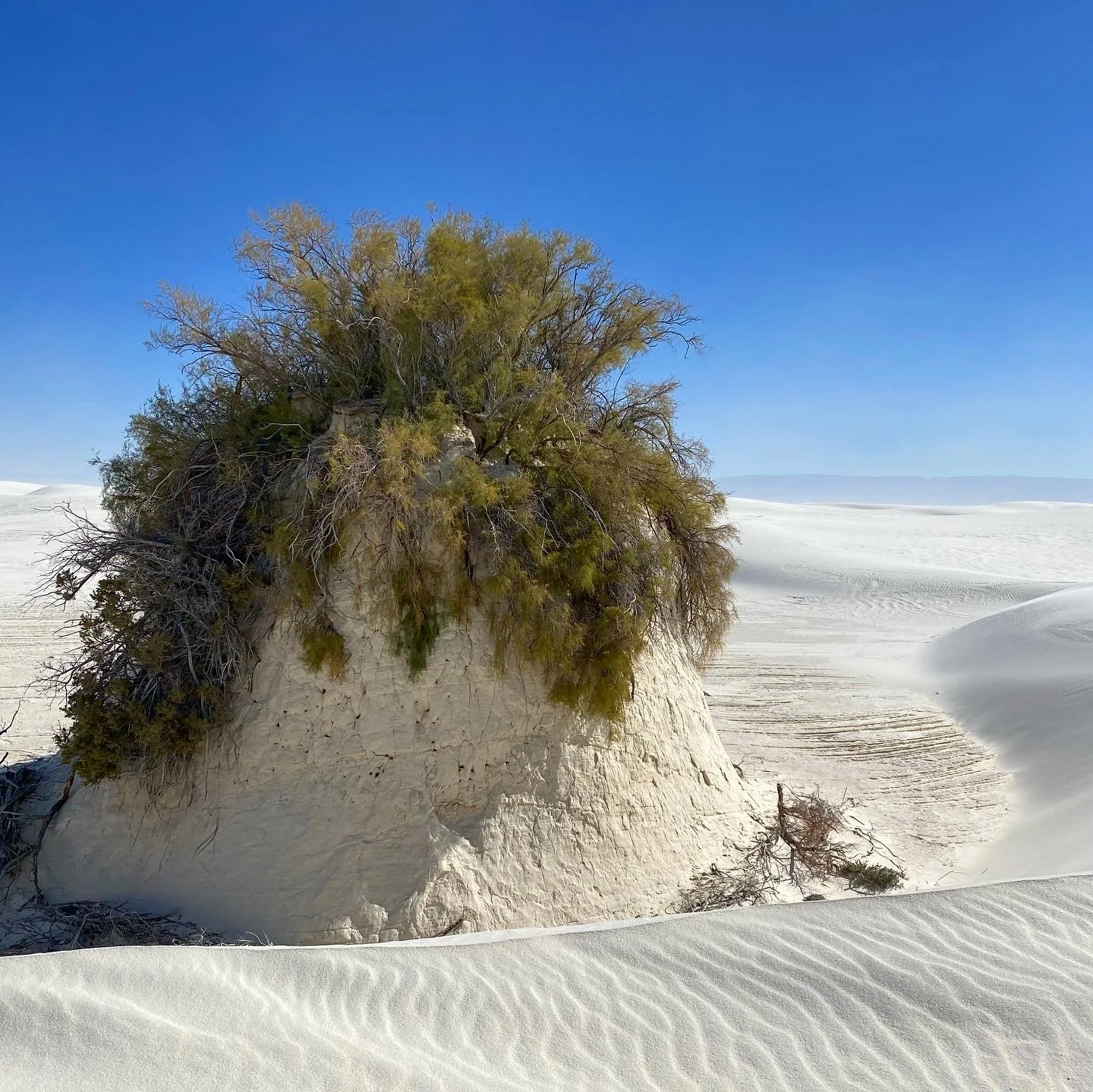
This October, Andy Robertson, Zack Ansell, and Josh Balsiger from GSS traveled to New Mexico to conduct Draft Map Review of wetlands alongside New Mexico Environment Department staff scientists from the Surface Water Quality Bureau (SWQB) Maryann McGraw, Daveena Crosley, Emile Sawyer, James T. Jones and Regional Wetland Coordinator Gary Hunt. Josh Balsiger, GSS Technician, said of the experience working with SWQB staff, “learning first hand from scientists who’ve devoted their lives to the study of the ecological system taking place in front of you is eye-opening.” They traveled west to east across New Mexico’s southern border, from large alkaline playas in Lordsburg, across the otherworldly landscape of White Sands National Park, to areas of robust karst topography south of Roswell. From there, they went north from the Permian Basin into the Eastern Plains where they answered questions about the high desert playas. The trip culminated in Santa Rosa, where the high water table produces saturation year-round and spring influence dominates the hydrology.
Special time was taken in White Sands National Park, home of the world’s largest gypsum dunefield, as the unique hydrology plays an essential role in the maintenance of the gypsum dunes that have become iconic of the southwest. Just inches below the surface of the dunes, the sand is wet, which helps hold the dunes together. “Walking into White Sands National Park, you feel as though you have stepped into another world,” said GSS Technician Josh Balsiger.


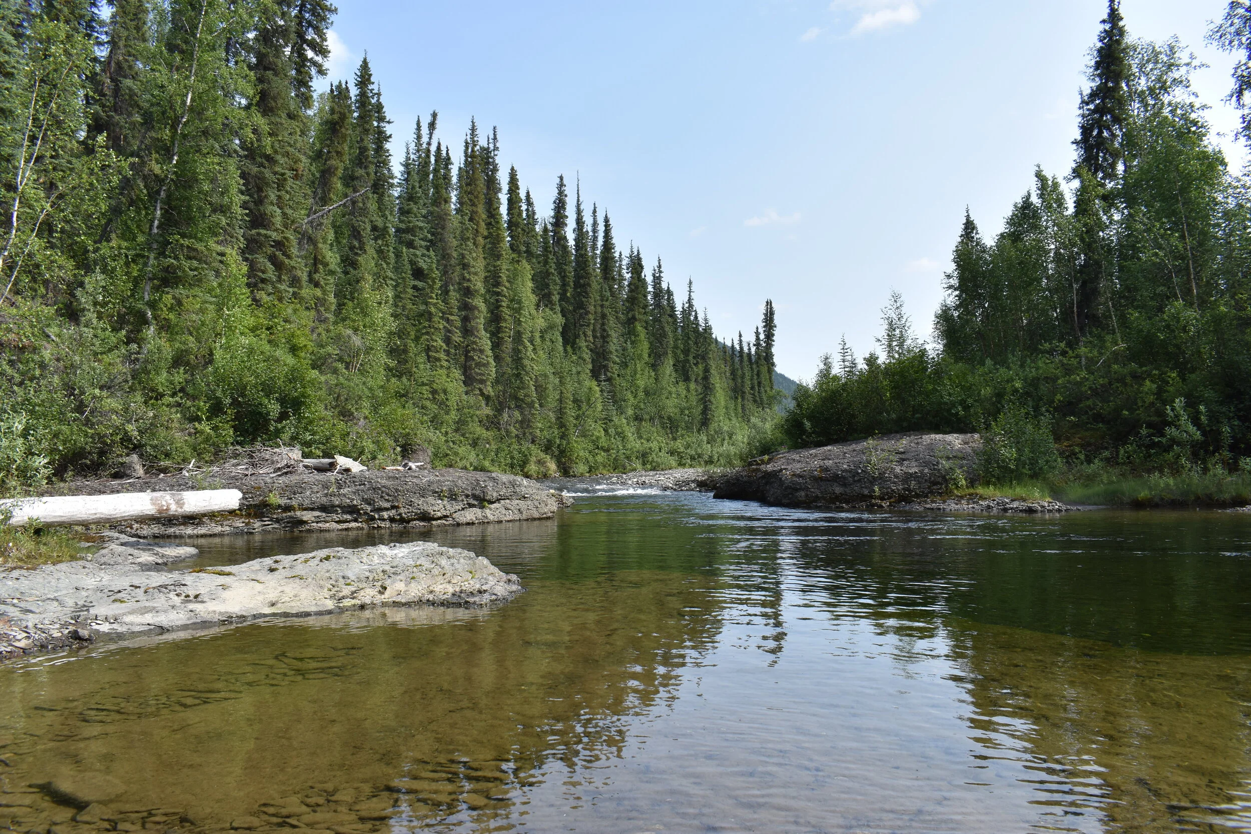
GSS Fieldwork Continues with California Trip
In September, GSS staff members Kevin Stark and Keely Hansen traveled to Northern California for seven days to complete a wetland mapping fieldwork trip. The study area covered varying ecoregions along the California coast north of San Francisco and north of Napa Valley. These fieldwork efforts allow GSS staff to complete critical field verifications of previously observed digital aerial imagery and photointerpretation conventions for the U.S. Fish and Wildlife Service National Wetlands Inventory (NWI) program. Staff were able to evaluate draft data on the fly utilizing state of the art technology, and were able to compare what they were seeing in the field with what GSS staff had previously mapped in real time. Using Esri Field Maps mobile application, and ArcPro mapping software running on a Panasonic ToughBook, the team was able to bring back valuable data and observations.
During this particular trip, Kevin and Keely traveled across robust landscapes that included arid plains, irrigated farmlands, high elevation montane forests, and many seeps and springs. Of significance on this visit were observations of the California coastline and the various estuarine wetlands that are very unique compared to the typically arid western lands that GSS encounters. Additional insights gained included an enhanced understanding of how wetlands in the west have responded to historic drought conditions, as well as how water flows are manipulated to irrigate various croplands in California.


GSS Awards Student Fellowships
GeoSpatial Services is proud to announce the first-ever winners of our new GSS Fellowship: Connor Corey, Michelle Doering, Theresa DeGross, and Paulrisa Suah. These incoming students will receive a first-year $5,000 scholarship and a part-time paid internship with GSS throughout their college career, if they so choose, as well as ongoing professional and career development opportunities. The new students will begin their time at GSS by working on National Hydrography Dataset (NHD) projects.
The goals of the fellowship program are to attract high-potential undergraduate students and provide them with experiential learning opportunities that will prepare them for the workplace within their chosen disciplines. Additionally, this program will foster on-going collaboration between GSS and the University’s academic disciplines. GIS underpins many industries and current technologies, such as health care services, sales and marketing, emergency response, crime analysis, climate change, real estate, and environmental management. The U.S. Department of Labor predicts that GIS skills will be in high demand over the next decade, with average annual salaries of $70,000.

GSS Fellows (l-r) Michelle Doering, Theresa DeGross, and Connor Corey (not pictured: Paulrisa Suah)
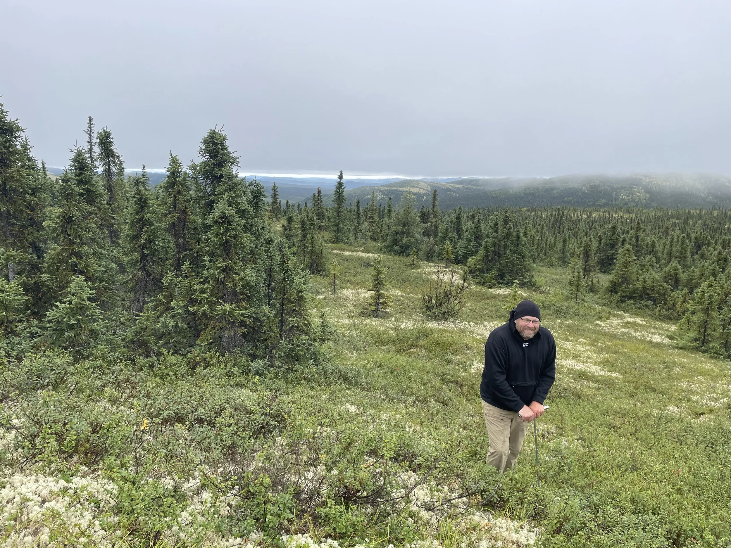
Another BIG Summer in Alaska for GSS Staff
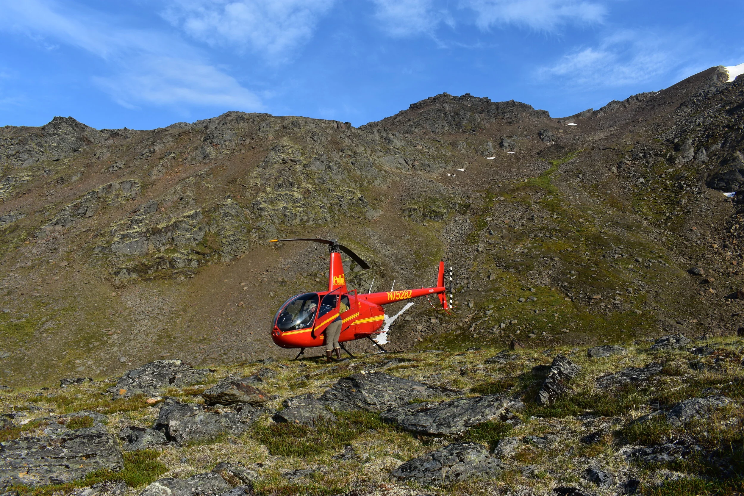
GeoSpatial Services (GSS) has once again completed a very significant season of fieldwork in Alaska. Four teams from GSS travelled to the “Land of the Midnight Sun” this year to complete field verification of wetlands. These trips are required for current and future mapping projects in support of the National Wetland Inventory (NWI), managed by the US Fish & Wildlife Service (USFWS). Due to the remoteness of the study areas, most field work is done by helicopter.
The field season was started off by Director Andy Robertson and GSS Technician Ian Robertson. The team utilized Galbraith Lake airstrip along the Dalton highway and was also based out of the Arctic Village airstrip near a native community, as well as Kavik Camp located in the Arctic National Wildlife Refuge (ANWR).
The Robertsons passed off the use of the helicopter and pilot to the team of GSS Technician James Loken and Analyst Eric Lindquist for the second leg of GSS work. Their week consisted of field verification for projects located on the North Slope of Alaska’s National Petroleum Reserve (NPRA), as well as project areas south of the Brooks Range Mountains.

Trip #3 was handled by GSS Assistant Director Kevin Stark, who was accompanied by Eric Lindquist. The pair were responsible for areas on the south side of the Western Brooks Range as well as areas moving west towards Kobuk Valley, Noatak National Park, and further west towards the community of Kotzebue.
The final leg of the trip was the team of GSS Analyst Katie Engelmann and Eric Lindquist, who moved the helicopter and worked south near the town of McGrath. Their project study areas were west of Denali National Park, near McGrath, Galena and other small villages.
GeoSpatial Services is the largest contributor to the National Wetland Inventory and is a major partner with many agencies in Alaska as well as the lower 48. GSS currently employs 24 full-time staff and nearly 40 students at any given time. Acquiring new projects and completing fieldwork are only a few steps in the process of completing the updated digital mapping products for their clients.


GSS Staff Continue Travels
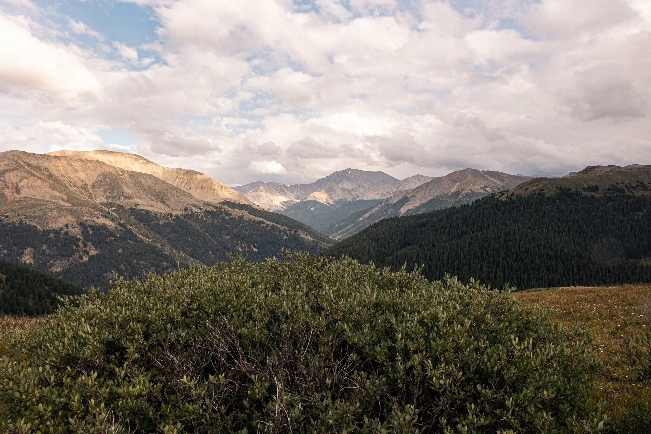
In late August, Analyst Eric Lindquist and Technician Matt Hogan completed their fieldwork for the Colorado portion of the Bureau of Land Management’s NWI wetland mapping update project. The trip lasted 9 days, evaluating mainly draft map data and answering questions about the landscape that are difficult to interpret from analyzing imagery on the computer. The study area encompasses many different ecoregions in the south and west part of the state, near towns such as Grand Junction, Telluride, Durango, Alamosa, and Cañon City. Using the technology of Esri Field Maps application, and ArcPro mapping software, Eric and Matt were able to bring back valuable pieces of intelligence for everyone involved in completing the project to reference.


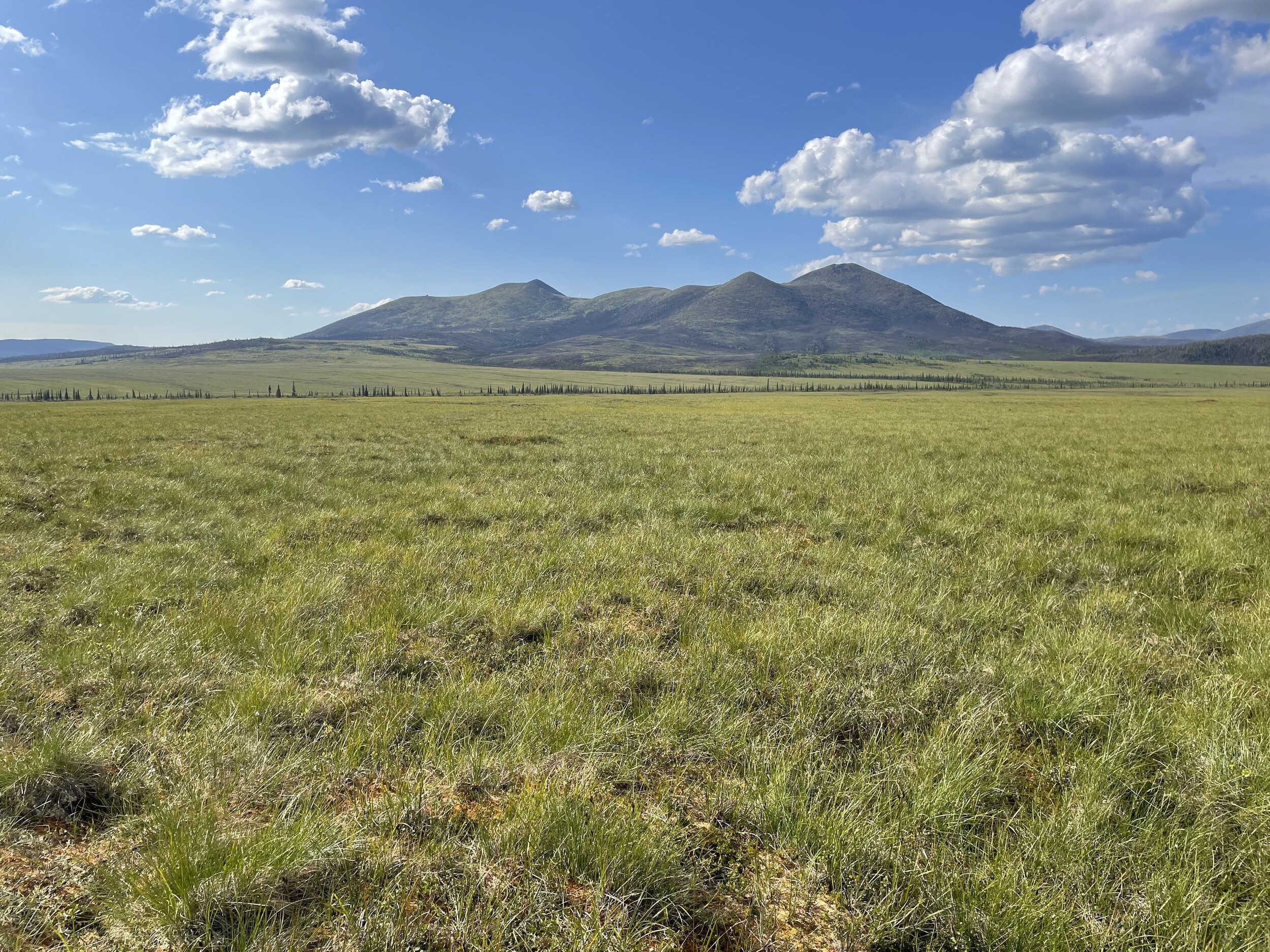
Busy Field Work Season Begins
From May 16-22, six GSS staff members traveled across central and northwestern North Dakota to conduct field verification of aerial imagery and photointerpretation conventions for the National Wetland Inventory (NWI) update. Staff split into two teams to cover more ground, with Kevin Stark, Darren Omoth, and Mike Knudson in one vehicle, and Nick Lemcke, Jeff Knopf, and Kathy Allen in another. During the week, the GSS teams were joined by U.S. Fish and Wildlife Service (USFWS) staff from the Regional NWI program for three days, and also met up with local USFWS managers in the Crosby area and at Lostwood National Wildlife Refuge. Highlights of the trip included visiting the many National Wildlife Refuges scattered across the state, including some alkaline lakes and flats that serve as habitat for the threatened piping plover (Great Plains population), and spotting a wide variety of waterfowl and wading birds.


Locations of check-sites that were visited during May field verification.
Congratulations to our graduating students!

SIXTEEN of our student technicians here at GSS are members of the SMUMN graduating Class of 2021! We congratulate them on all their accomplishments and wish them the best in their next adventures!
Cece Abel Nasteho Ahmed
Kayla Boettcher Shane Breslin
Crystal Chavez Beth Davis
Aly Deegan Klaus Friedli
Hannah Hagberg AnnMarie Jacobsen
Nick Nast Ted Sweet
Breanna Tews Kieran Walsh
Sion Williams Fletcher Zuerlein