NEWS
Returning to the West
In August, staff members Eric Lindquist, Matt Hogan, and Klaus Friedli completed draft map review fieldwork for the most recent Wyoming NWI update project. The trip lasted 10 days, conducting field verification and collecting photos in the project area. The trip brought us to interesting towns such as Ten Sleep, Cody, Lander, and Dubois. Klaus’s botany and plant identification skills made it easier to identify wetland indicator species during a particularly dry season. The project area encompasses multiple ecoregions including some of the following: Rolling Sagebrush Steppe, Black Hills Plateau, Granitic Subalpine Zone, Mid-Elevation Forest and Scrublands, and Powder River Basin. The field crew was able to collect data on the fly using data collection iOS applications from ESRI along with a Toughbook displaying multiple collateral datasets. The team has solidified their knowledge of wetland mapping in Wyoming after completing this third round of fieldwork in the state over the last several years. This project is set to be completed and delivered in 2023.
Tribal Collaboration Continues
In mid-August, five GSS staff members and one student travelled to the Leech Lake Reservation in north-central Minnesota to collect lake sediment cores for a phosphorus flux analysis. Kevin Stark, Eric Lindquist, Kathy Allen, Randy Krainock, Mary Larson, and Katrina Danzinger, along with Jake Sorensen from the Leech Lake Band of Ojibwe (LLBO), sampled water quality and collected seven cores each from Bowstring and Round Lakes. The sediment cores will now be incubated in a lab on campus and sampled regularly to determine how much phosphorus is being released by the sediment. This will help determine whether nutrients stored in the lake sediment may be contributing to high phosphorus levels (internal loading) or whether elevated phosphorus levels are due to outside sources, such as fertilizers and septic systems (external loading). Elevated phosphorus levels can trigger excess algal growth and cause declines in dissolved oxygen, which can kill fish and other aquatic life.


Alaska Coastal Expedition
In late May, GSS staff members Andy Robertson, Kevin Stark, and Eric Lindquist travelled to the Alaska Peninsula to conduct fieldwork along Shelikof Strait and the Kodiak Archipelago. This trip was part of a larger project to map hydrography and wetlands along the southern coast of Alaska for the U.S. Fish and Wildlife Service and U.S. Geological Survey. This particular project falls within the area affected by the Exxon Valdez oil spill (EVOS), the impacts of which are still being studied. Due to the rugged and inaccessible nature of the Alaska coast, the majority of work had to be conducted by boat or helicopter. A “support boat” travelled along the Alaska Peninsula and served as a moving base of operations, providing the field crew with lodging, food, and helicopter fuel. The crew also spent several days surveying wetlands around the town of Kodiak by car, when low clouds made flying impossible.
Adventures on the Yukon and Andreafksy Rivers
For the first two weeks of August, GSS staff members Katie Engelmann, Michael Knudson, Emma Behling, and Klaus Friedli conducted two types of wetland identification field work based out of Saint Mary’s, Alaska, a remote village west of Anchorage. The field crew aimed to refine preliminary wetland mapping and identify conventions for the interpretation of the wide variety of wetlands in the area, and verify satellite imagery in relation to actual landscape ecology.
Engelmann and Behling were joined by the regional coordinator for the U.S. Fish & Wildlife Service, Sydney Thielke, and primarily collected data through helicopter flight and roadside surveillance. Knudson and Friedli were joined by four staff from the Yukon Delta National Wildlife Refuge, including the Refuge Manager Boyd Blihovde, and divided into two raft crews to float the North and East forks of the Andreafsky River and collect data through riverside hikes.
The Yukon River is almost 2,000 miles long, and by helicopter one field crew was able to visit its discharge into the Bering Sea. The team measured salinity and tidal influence in a wide band of wetlands at the coastline and further inland to determine the extent of tidal influence and saltwater on wetland ecology. The helicopter crew was also able to visit several mud volcanoes in the project area, investigate the impact of recent wildfires on wetland ecology, and gain a better understanding of broader landscape shifts as permafrost thaws and basins fill with water or drain and become vegetated.
The float crews tried their best to stay dry, and keep track of the countless wildlife they saw up close. By raft, the crews gained a unique insight into a remote and incredibly protected area that makes up a large portion of the study area. Their experiences and observations were invaluable in refining mapping conventions and understanding the movement of water across the landscape.
Finding Wetlands in the Arid West
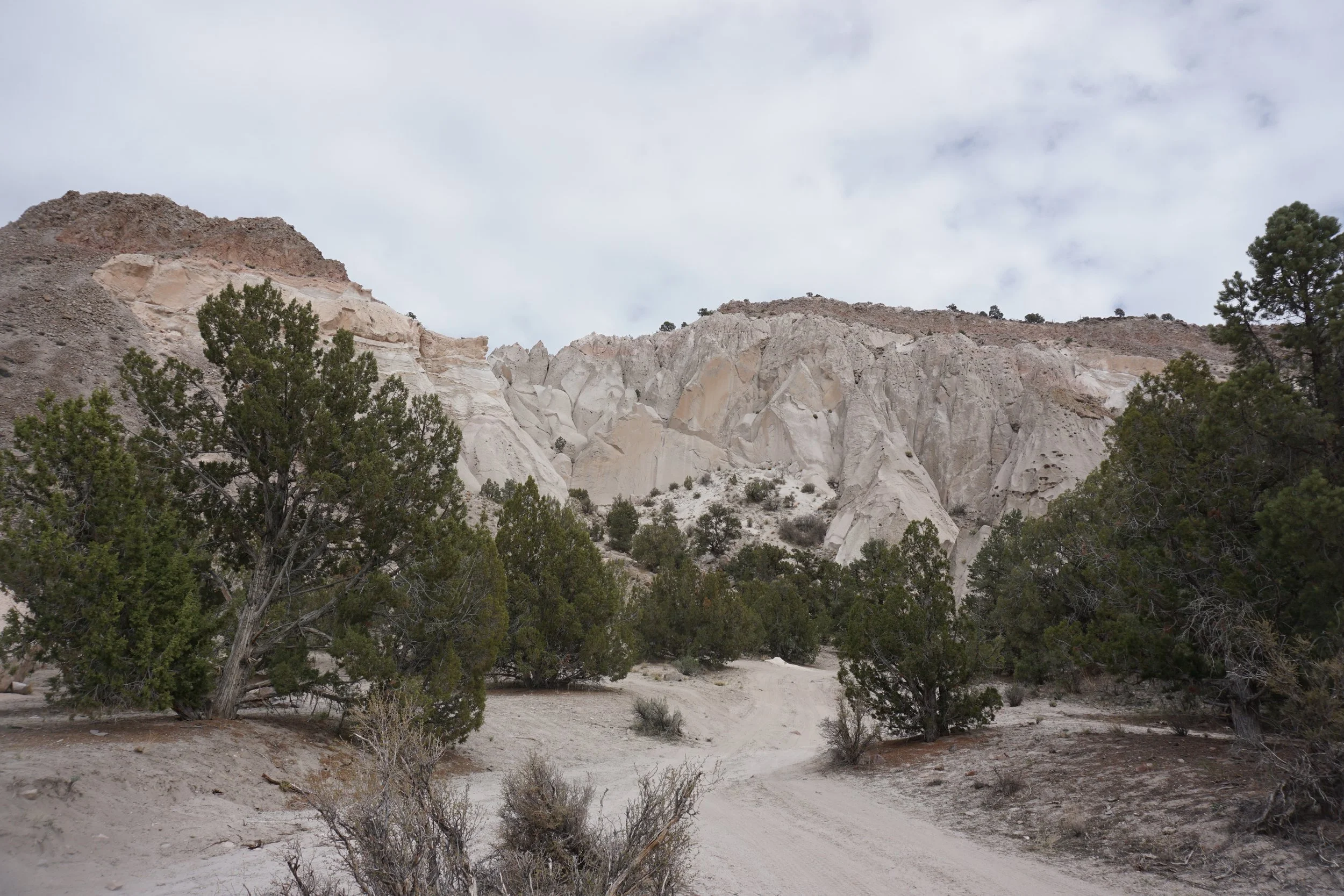
In early April, at the beginning of the GSS fieldwork season, GSS staff members Andy Robertson, Zachary Ansell, and Josh Balsiger conducted pre-mapping fieldwork for a Bureau of Land Management Project in Southeast Nevada, just outside Las Vegas. The purpose of the trip was to identify conventions for the interpretation of wetland matrices in the study area. GSS staff spent 8 days in Nevada, covering 2,156 miles, and collected data at 111 different pre-selected and ad-hoc checksites.
The arid west has unique hydrology that is characterized by localized precipitation events that play a big role in the hydrogeomorphology of the region. Features that GSS was able to develop wetland mapping conventions for included mineral flats, mountain springs, USFWS refuges, and high mountain drainage divides. Soil samples provided an important look into the hydric nature of soils at varying check sites and were especially interesting in high altitude depressions where water ponds when ephemeral flow paths upstream experience precipitation events.
The trip brought the team from the basins of prehistoric lakes to groundwater expressing springs gushing out of mountain sides, along with an occasional disappearing stream. It served to distinguish unique image signatures, identify water regimes and helped inform an understanding of the wetlands present in the study area.
Northern Great Plains Field Work
In early June, GSS staff members Nick Lemcke, Jeff Knopf, and Darren Omoth conducted fieldwork in north central North Dakota for an upcoming wetland mapping project designed with the purpose of creating a detailed wetland inventory to provide understanding of habitat conditions and management options for our U.S. Fish and Wildlife Service partners. The fieldwork covered the counties of Renville, Bottineau, Rolette, McHenry and Pierce. Field notes and pictures were acquired in order to document the landscape, vegetation, soil and hydrology at check site locations to establish a guide for identifying and classifying wetlands.
The highlights were time spent in the Upper Souris and J. Clark Salyer National Wildlife Refuges, primarily river valley wetland habitats which provide sanctuary for waterfowl and migratory birds. The trip also brought the team into North Dakota’s Turtle Mountains. These forested glacial-formed mountains are covered with hundreds of lakes and ponds. A perfect representation is the Wakopa Wildlife Management Area, which is found on the eastern side of the Turtle Mountains. Although only 700–800 feet above the plains, they are truly mountainous against the flat topography of the surrounding landscape.
GSS Student Intern Featured in Local Newspapers
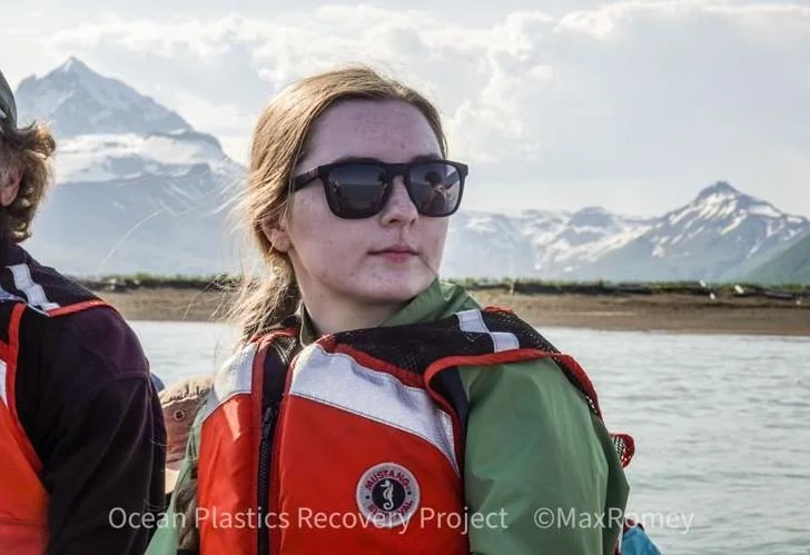
SMUMN senior Katrina Danzinger recently spent a week on the Alaska coast, working with the Ocean Plastics Recovery Project. Her experience was featured in the Winona Daily News, the La Crosse Tribune, and in the University’s newsroom. You can read the full story here. The highlight of the trip for Katrina was whale watching, including sightings of humpback whales.
GSS Spotlight!
Angelyssa Figueroa
Student Technician
What is your education and/or professional background?
I am a Psychology major, Criminal Justice minor and have been working at GSS for a little over 2 years.
What led you to GIS? More specifically, how did you get to Saint Mary's University and GeoSpatial Services in Winona?
Coming from Tucson, Arizona, I found Saint Mary's through a scholarship program that eventually brought me here to Winona. As a First Generation Initiative scholar, I am somewhat limited in job opportunities on campus, but plenty of my fellow scholars worked for GSS and told me how great it was! This piqued my interest and I found myself researching about GIS and what it means to work for GeoSpatial Services.
Explain briefly a project at GSS you've done that contributed to your overall knowledge and educational experience.
Honestly, just being a part of GSS and mapping in places like Colorado and Wyoming have taught me about the importance of the work we do here. We help create maps and plans that will be used for businesses, parks, and organizations, which is impactful and valuable work that shows me that my work makes a difference, no matter how big or small the project.
How do you see GIS fitting into your future?
GIS has strengthened my ability to adapt as you're constantly working on new projects and learning about a wide variety of areas. I know how to look at topographic maps and identify plains, water sources, roads, and lots more. GIS has definitely helped me become a well-rounded individual that is able to confidently step into known and unknown fields and be ready to make an impact wherever I go.
Where can we find you outside of GSS?
If I am not at GSS, and the weather is nice and sunny, then I'll usually be out enjoying the sun or spending time with friends!
Robertson Appears on Local News
To mark National Environmental Education Week, GSS Director Andy Robertson spoke about climate change in a segment on Mason City’s KIMT local news. He addressed the shift in frequency of extreme weather events related to climate change: “The randomness of change - related to climate warming - is what has the greatest impact. It could be increased precipitation, it could be decreased precipitation. It could be decreased heat. It could be cooling at the wrong time of year. So the lilac bushes were the best example of the past year where the lilacs bloomed like they normally do in the spring, but then bloomed a second time in the fall because we had a warming period and a drying period. It got them out of sync. And now the speculation is they're not going to bloom at all this spring." See the full story here.
GSS SPOTLIGHT!!
Ben Moonen
Student Technician
What is your education and/or professional background?
I am currently a senior at Winona State University and I am studying Ecology and minoring in GIS. I have been working here at GSS for almost 6 months now.
What led you to GIS? More specifically, how did you get to GeoSpatial Services in Winona?
I discovered GIS when an advisor suggested that I look into minors and the GIS minor happened to fit best into my schedule. Then a friend who was working at GSS suggested that I apply and that the work here would be a good experience if I was to continue pursuing a career in natural resources.
Explain briefly a project at GSS you've done that contributed to your overall knowledge and educational experience.
My experience here started with projects in Alaska. It has been eye-opening to see the scope of the wetlands in these projects. I have been able to improve my skills of using the software while also learning new applications for GIS.
How do you see GIS fitting into your future?
I see GIS being a major part of my future. I see it as a valuable skill that will be an important tool if I continue to pursue a career in natural resources.
Where can we find you outside of GSS?
If I am not at GSS, I am at home with my wife and our dog or I am in the woods hunting or on the water fishing.


