NEWS
Robertson & Kramer present at NTICC in Anchorage, Alaska
GSS Director Andy Robertson recently attended the National Tribal & Indigenous Climate Conference (NTICC) in Anchorage, Alaska. He was accompanied by Larissa Kramer, a GSS employee residing in Anchorage and a member of the Bristol Bay Native Corporation.
Together, they presented on GSS’s work in the Bristol Bay Region, which creates wetland spatial data and highlighting our innovative projects and collaborations with Indigenous communities as well as partnering with Tribal Communities to provide work-integrated learning opportunities for Tribal youth.


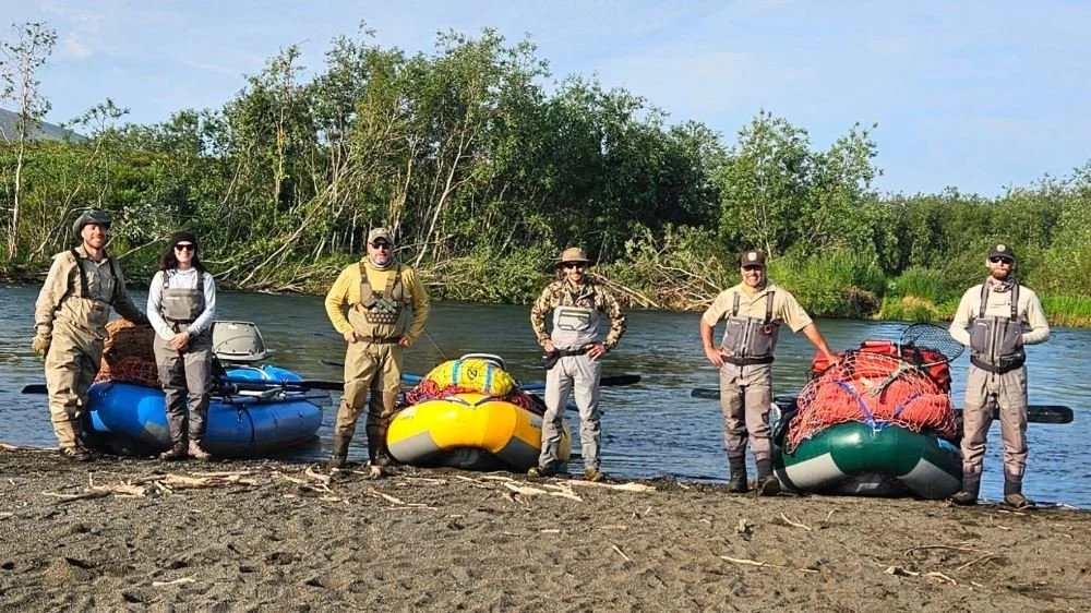
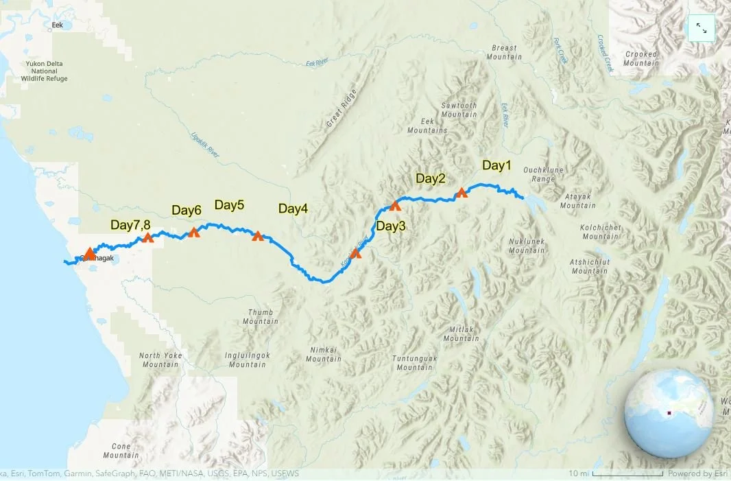
Interagency Collaboration: GSS Floats the Kanektok
In late July, GSS staff members Ben Moonen and Eric Lindquist participated in an interagency river float in the Alaskan wilderness of Togiak National Wildlife Refuge. During the 80-mile float trip on the Kanektok River, Ben and Eric’s goal was to understand and map the river and its surrounding landscapes within the USFWS NWI Mapping standards. For more information and photos about the trip, explore the story map here!
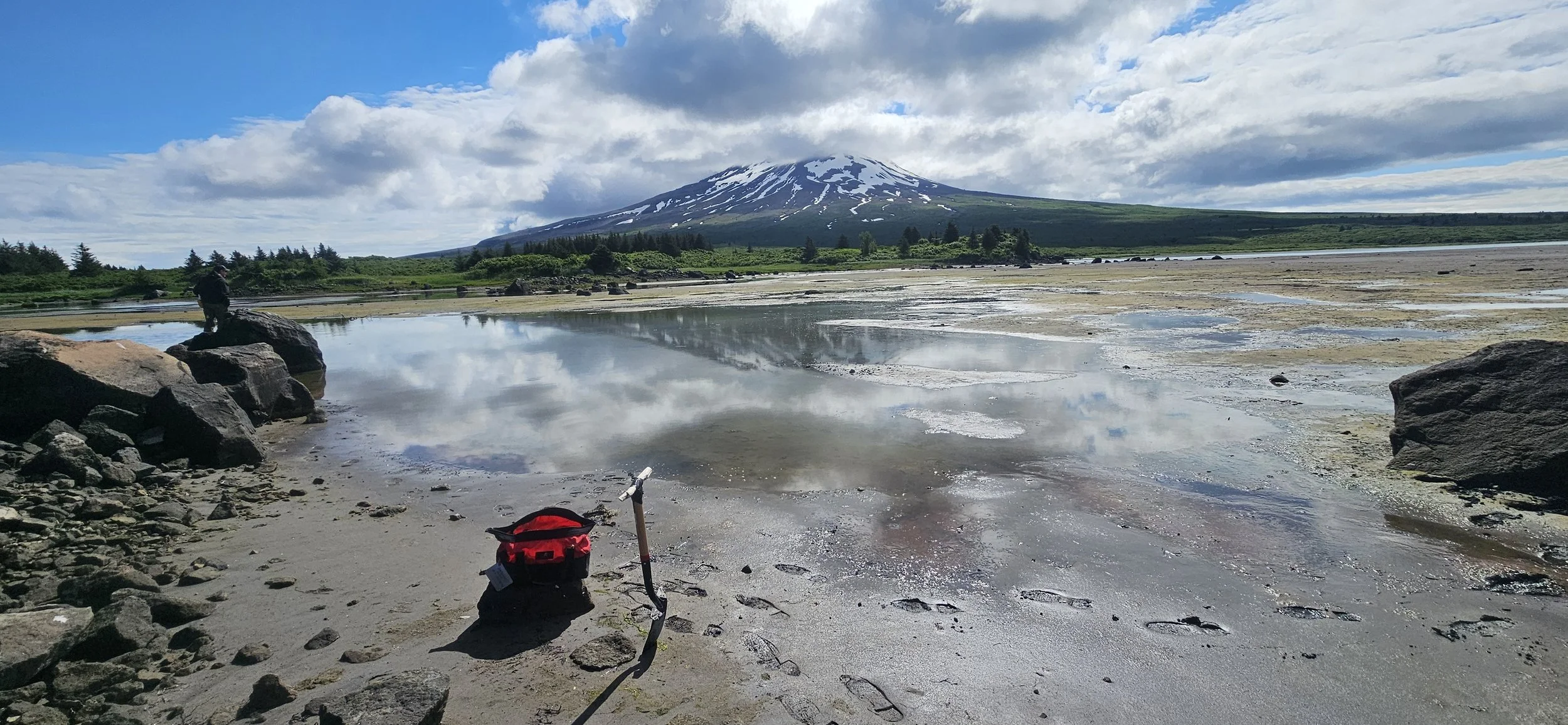
Stark and Lindquist Joined by USFWS in Southern Alaska
GSS Assistant Director Kevin Stark and Eric Lindquist continued our extensive field season in Alaska, traveling many miles across southern Alaska in mid-July, to collect field data for a project funded by the Exxon Valdez Oil Spill Trustee Council. This project is the second of its kind that GSS has undertaken, stemming from funds allocated after the 1989 Exxon Valdez oil spill.
This season, their field verification work spanned from Valdez and the Copper River Delta, across the Kenai Peninsula, over Cook Inlet, and down to the northern end of Katmai National Park. During their time in Cordova, they were joined by a member of the U.S. Fish and Wildlife Service's National Wetlands Inventory (USFWS NWI).
Additionally, GSS staff had the opportunity to reconnect with two Saint Mary's University alumni, Danielle Braun (‘08) and Katrina Danziger (‘23), who reside in the Kenai and Soldotna areas of the Kenai Peninsula. Photos of their visit are included below.


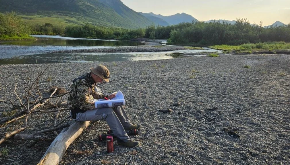
Robertson, Ryan & Lindquist Continue GSS’s Alaska Field Season
In July, Executive Director Andy Robertson, along with staff members Nicole Ryan and Eric Lindquist, continued GSS’s field work in Alaska. The team focused on Katmai National Park and the northwest portion of the Alaska Peninsula. Throughout the Alaska field season, GSS field crews have been correlating satellite imagery and digital mapping of wetlands with on-the-ground observations. The team records plant identification, soil composition, landscape position, and other elements of the landscape, which are then brought back to the teams at Saint Mary's University of Minnesota (SMUMN). This data contributes to the US Fish and Wildlife Service's National Wetlands Inventory (USFWS NWI).
GSS has been involved in updated mapping projects across Alaska and other parts of the US for many years. Staff and students utilize Geographic Information Systems (GIS) software, literature, local knowledge, and other ancillary elements to create data for use and analysis by federal, state, county, and tribal entities across the United States.


GSS Student Intern Assists with Alaska Research
During the month of July, GIS Intern Luke Shappell accompanied a small team from the National Oceanic and Atmospheric Administration (NOAA) on a 28-day research cruise designed to sample and study Pacific cod and gadid (fish in the cod family) populations and their habitats along the Alaskan Peninsula. The NOAA team employed seine nets to drag sites that were rich in kelp and eelgrass (common habitat for gadids) while simultaneously utilizing baited underwater cameras to potentially capture images of young and juvenile cod. Starting in Kodiak and spanning from Sand Point to Seward, the research team sampled over 120 different beaches and cliffs that were located in various bays and islands along the coast. The collected gadids were then further processed with pre-lab work, such as collecting fin samples for genetic testing, that would enable more scientific examination following the voyage. The team's research endeavors, which will end next year (2025), stemmed from a drastic decrease in the Pacific cod populations in 2017, following a dramatic increase of water temperatures in the Gulf of Alaska that was nicknamed “the Blob.” NOAA hopes the data they’ve collected will allow experts to create a predictive model that can help monitor and estimate gadid populations based on measurable variables such as water temperature and salinity.


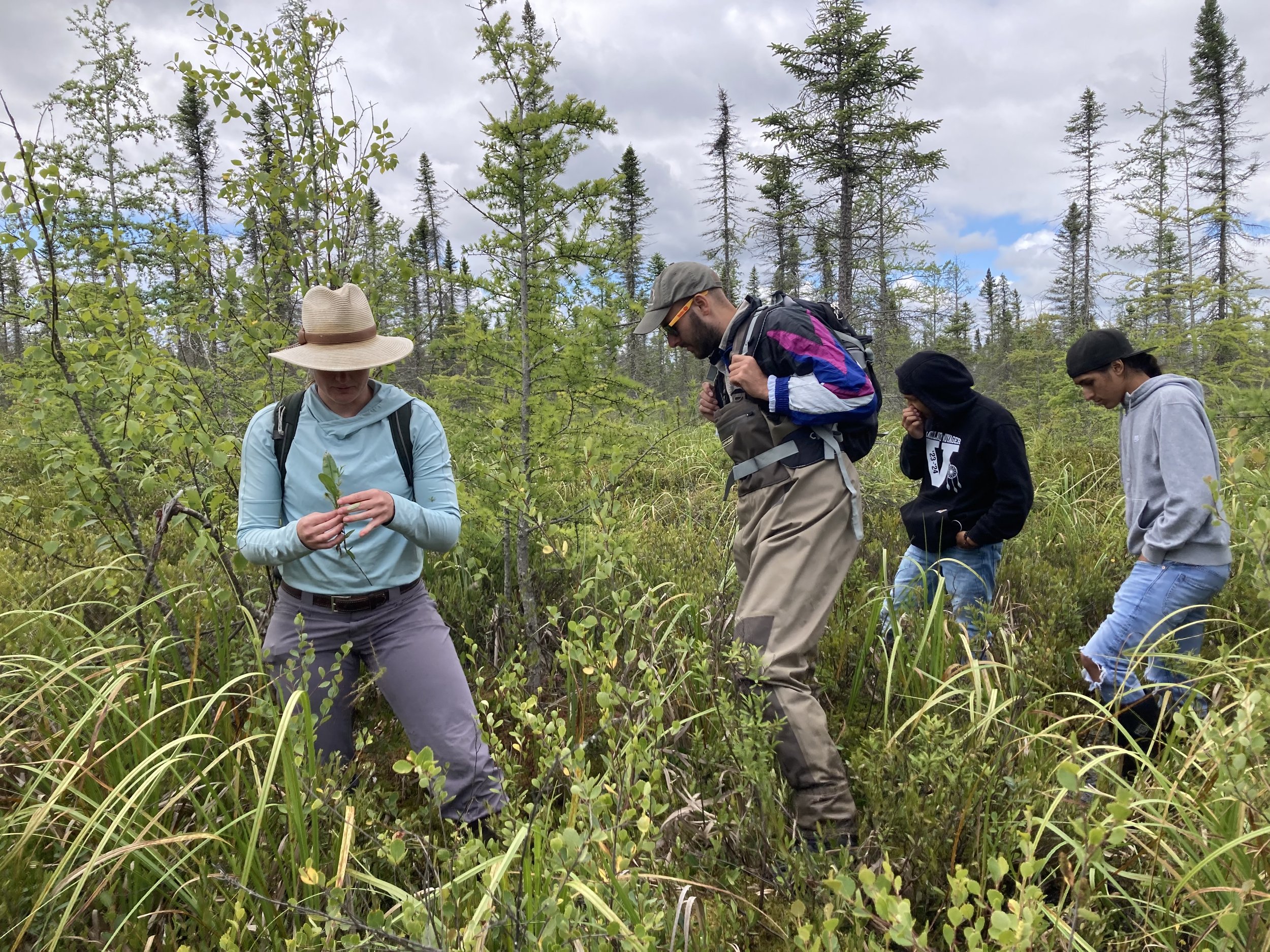
GSS Assists with Wetland Training for Tribal Staff
In July, GSS Analysts Elise Rosengren and Kathy Allen assisted the Region 5 Tribal Wetland Working Group (TWWG) with one-day wetland plant identification training sessions for tribal staff in northern Minnesota and Wisconsin. The northern Minnesota session took place on the Fond du Lac Reservation near Cloquet, while the Wisconsin session was on the Lac du Flambeau Reservation near Minocqua. The trainings were planned through a partnership between the TWWG, the National Association of Wetland Managers (NAWM), and Saint Mary’s University, with funding from the Environmental Protection Agency (EPA). Staff from 10 different tribes attended the two sessions combined. The trainings were led by botanists and wetland scientists from the Minnesota and Wisconsin Departments of Natural Resources and the Minnesota Pollution Control Agency.
The Region 5 TWWG is a tribally-led collaborative that includes Tribal wetland staff from across EPA Region 5 (including Michigan, Wisconsin, Minnesota, and Indiana). The mission of the group is to facilitate collaboration and networking among Region 5 tribes to build tribal program capacity and staff expertise related to wetland management, monitoring, restoration, and conservation. The TWWG hopes to grow as a venue for information sharing and knowledge transfer, and to provide even more training opportunities for its members!


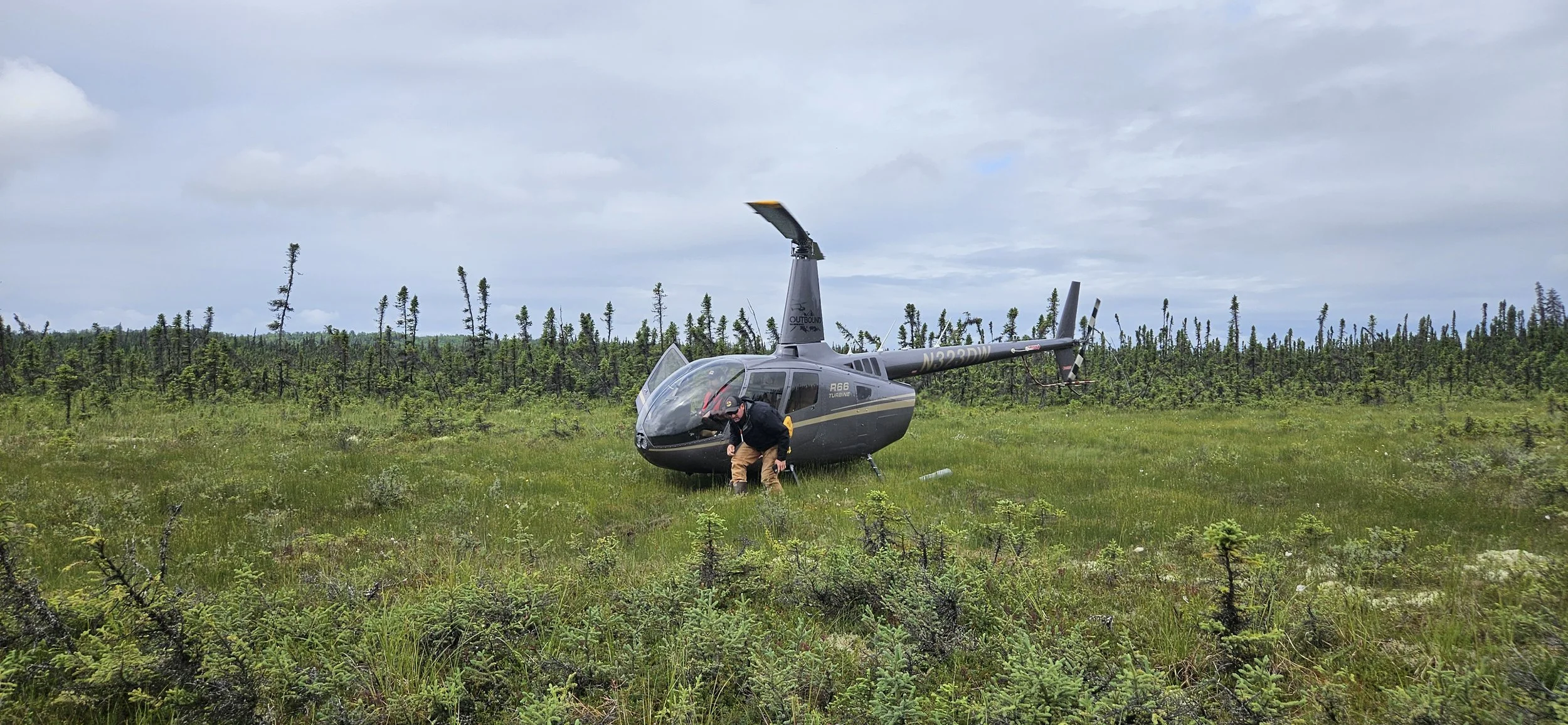
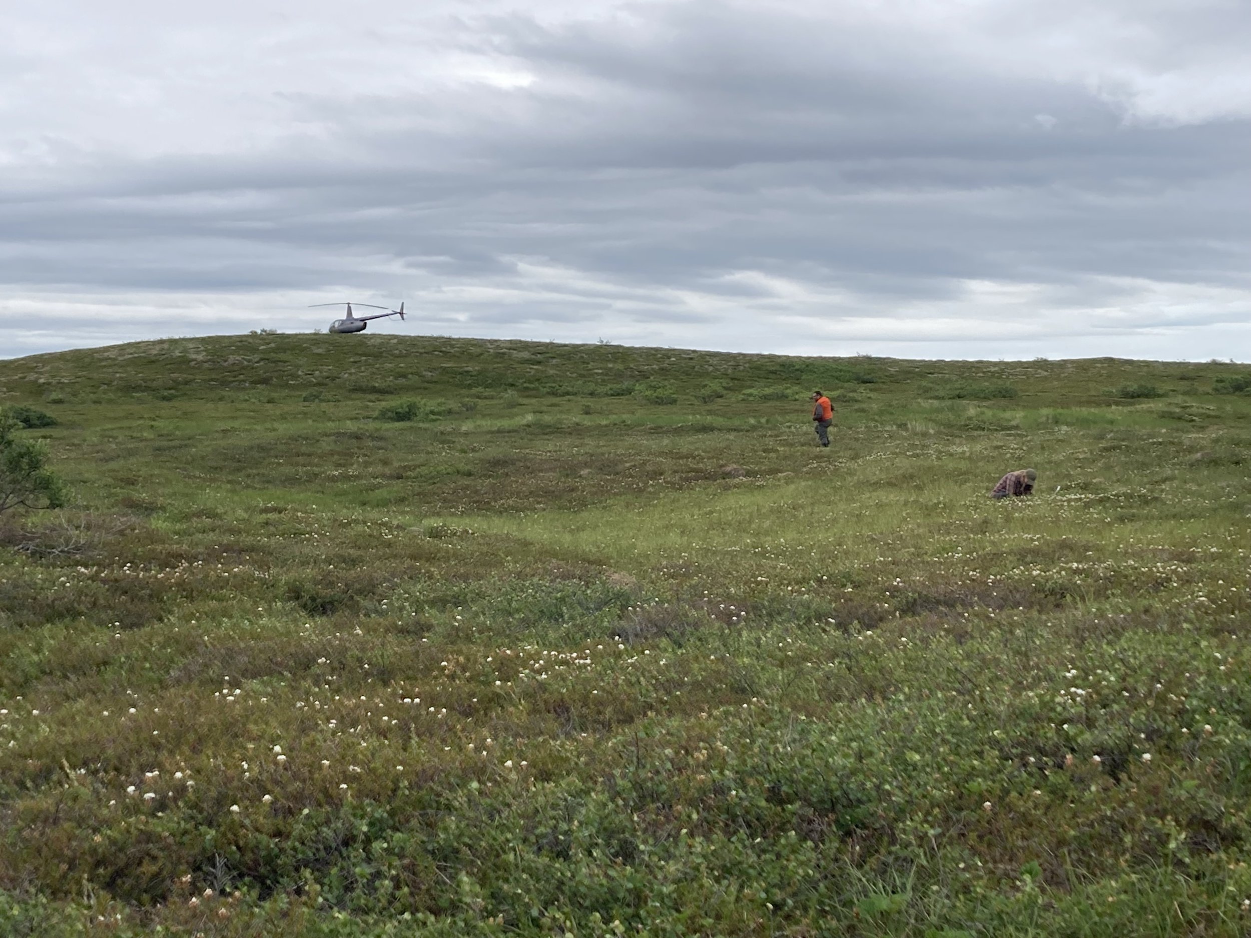
Alaska Field Work Kicks Off
In the third week of June, Katie Engelmann and Kathy Allen started off GSS’s Alaska helicopter field season with a 10-day trip in the Bristol Bay Fisheries Reserve wetland mapping project area. They were based out of Dillingham for five days, surveying areas including Togiak National Wildlife Refuge and Wood-Tikchik State Park. The remaining five days were based out of King Salmon, on the Alaska Peninsula along the Naknek River. From there, the team visited Becharof National Wildlife Refuge, including lands around Iliamna Lake and Becharof Lake. Unique geologic features include Mount Peulik, Ukinrek Maars and the Gas Rocks formation. For the final two days of the trip, Katie and Kathy were joined by fellow-analyst Nicole Ryan, who stayed on to assist with the next phase of field work. The team was also joined by U.S. Fish and Wildlife Service Regional Coordinator, Nick Jones, for 3 days. The team conducted vegetation and soil data collection in wetlands utilizing methods developed by the Alaska Geospatial Council Vegetation Technical Working Group. Wildlife sightings (from the helicopter) included moose, caribou, brown bear, ptarmigan, and tundra swans. Special thanks to Kurt of Pollux Aviation for his excellent piloting.


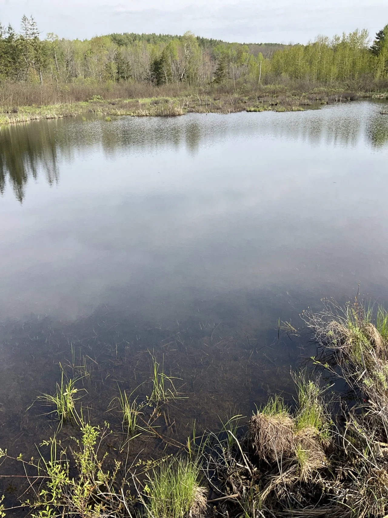
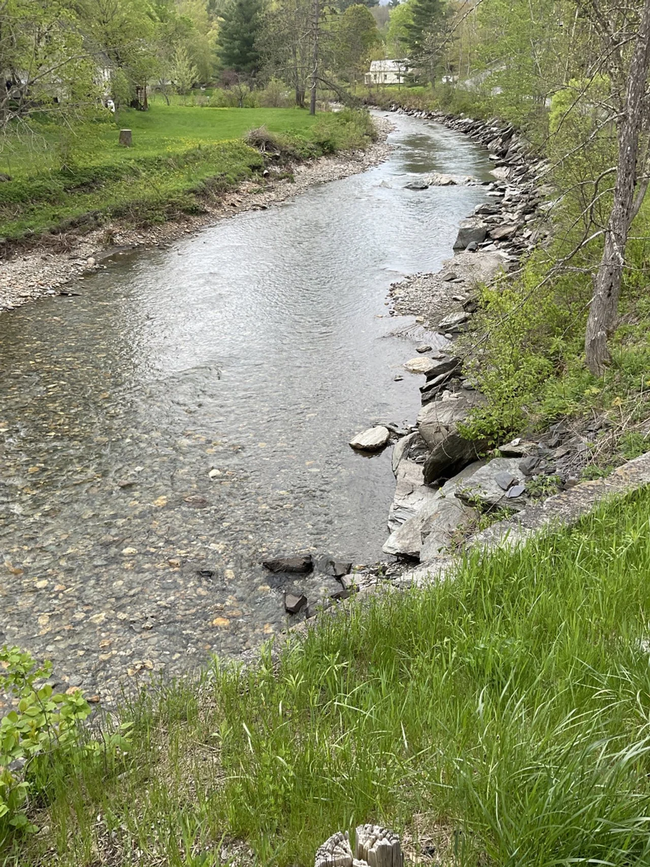
GSS Travels to Vermont
In mid-May, Kevin Stark, Nick Lemcke, and Zack Ansell spent a week in the Winooski and Otter Creek tactical basins of central Vermont, ground-truthing wetland mapping for an NWI update project with the state’s Department of Environmental Conservation (DEC). The GSS team was joined in the field by wetland ecologists and environmental analysts from the DEC, as well as the U.S. Fish and Wildlife Service’s Regional NWI Coordinator. Vermont is a very diverse landscape and contains many different wetland types, including open water ponds, floodplains, marshes and swamps, bogs, fens, wet meadows, and vernal pools. Over the week, the crew traveled an area roughly between Montpellier, Burlington, and Middlebury, visiting various wetlands from the Winooski River floodplain to Chittenden Reservoir in the Green Mountain National Forest. Different focuses were on saturated forested wetland environments, agricultural fields, and river floodplains. The diversity of forested wetlands in the state is very interesting, with a wide variety of tree species including spruce, fir, cedar, tamarack, hemlock, ash, and maples.


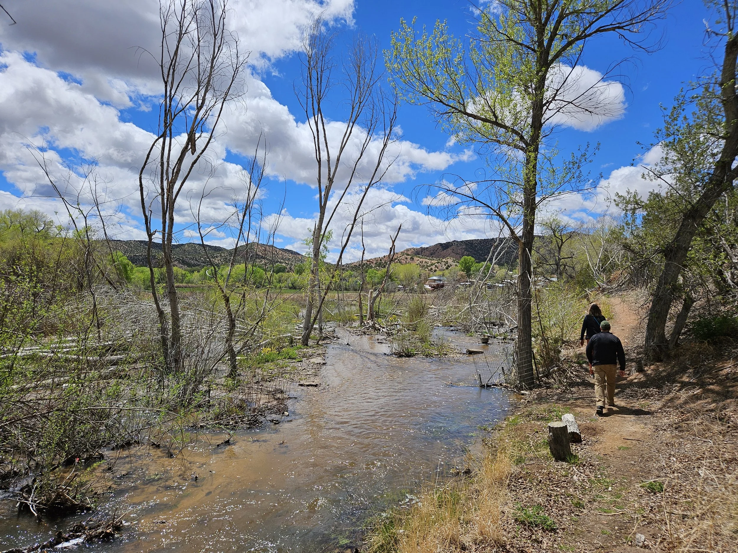
GSS Returns to New Mexico
In mid-April, Andy Robertson and Zack Ansell spent a week in northern New Mexico, reviewing wetland data as part of the New Mexico Mapping update project. The main objective of this trip was to look at the past wetland mapping, especially in the major river corridors, as the project's current focus is updating floodplain mapping and narrow linear habitat connections. They also explored how some of the wetland landscapes have changed due to restoration projects. While in the field, Andy and Zack spent time with wetland staff from the New Mexico Environment Department (NMED) and the U.S. Fish and Wildlife Service Regional Wetland Coordinator, as well as project partners from the non-profits Rio Grande Return and Amigos Bravos.
The team started out in Santa Fe, headed north to Taos, and continued towards the Cruces Basin Wilderness Area. They then turned east to Clayton, near the Texas border, and worked south, down to Ute Reservoir, before heading west along the Canadian River back towards Santa Fe. All together, they traveled roughly a 2,000 mile loop. Highlights of the trip included seeing the impacts of restoration work in high-elevation wetlands, and how quickly water regimes can change as a result. For example, beaver dam analog restoration sites showed many benefits, not only for wildlife and water quality but also for local agricultural communities.