

NEWS
GSS Staff Continue Travels
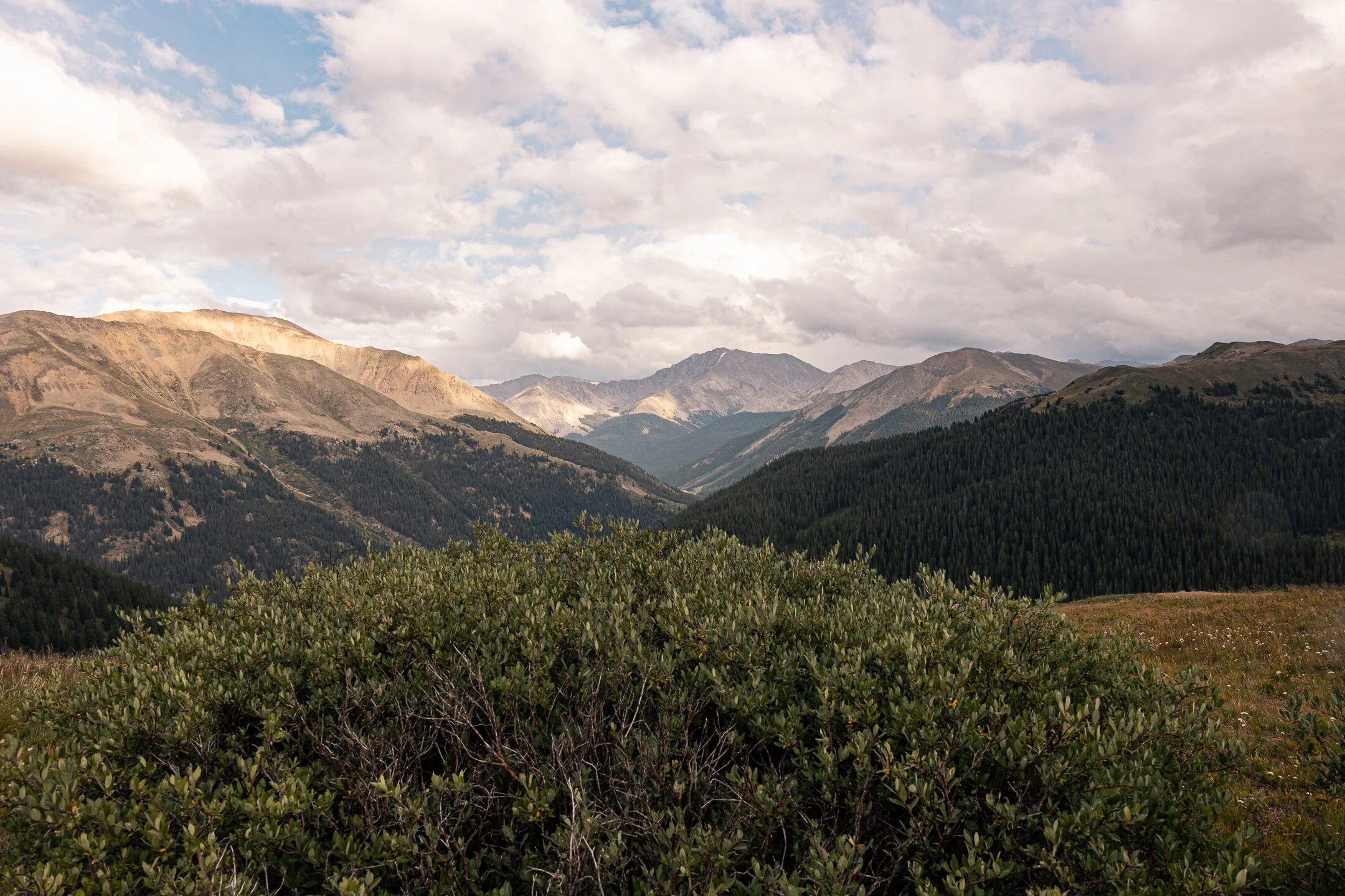
In late August, Analyst Eric Lindquist and Technician Matt Hogan completed their fieldwork for the Colorado portion of the Bureau of Land Management’s NWI wetland mapping update project. The trip lasted 9 days, evaluating mainly draft map data and answering questions about the landscape that are difficult to interpret from analyzing imagery on the computer. The study area encompasses many different ecoregions in the south and west part of the state, near towns such as Grand Junction, Telluride, Durango, Alamosa, and Cañon City. Using the technology of Esri Field Maps application, and ArcPro mapping software, Eric and Matt were able to bring back valuable pieces of intelligence for everyone involved in completing the project to reference.


Busy Field Work Season Begins
From May 16-22, six GSS staff members traveled across central and northwestern North Dakota to conduct field verification of aerial imagery and photointerpretation conventions for the National Wetland Inventory (NWI) update. Staff split into two teams to cover more ground, with Kevin Stark, Darren Omoth, and Mike Knudson in one vehicle, and Nick Lemcke, Jeff Knopf, and Kathy Allen in another. During the week, the GSS teams were joined by U.S. Fish and Wildlife Service (USFWS) staff from the Regional NWI program for three days, and also met up with local USFWS managers in the Crosby area and at Lostwood National Wildlife Refuge. Highlights of the trip included visiting the many National Wildlife Refuges scattered across the state, including some alkaline lakes and flats that serve as habitat for the threatened piping plover (Great Plains population), and spotting a wide variety of waterfowl and wading birds.


Locations of check-sites that were visited during May field verification.
Congratulations to our graduating students!

SIXTEEN of our student technicians here at GSS are members of the SMUMN graduating Class of 2021! We congratulate them on all their accomplishments and wish them the best in their next adventures!
Cece Abel Nasteho Ahmed
Kayla Boettcher Shane Breslin
Crystal Chavez Beth Davis
Aly Deegan Klaus Friedli
Hannah Hagberg AnnMarie Jacobsen
Nick Nast Ted Sweet
Breanna Tews Kieran Walsh
Sion Williams Fletcher Zuerlein
GSS partners with WSU and Winona Historical Society
In 2017, the Winona County Historical Society (WCHS) discovered a nearly 120 year-old transcribed copy of the original Public Land Survey (PLS) notes for Winona Township in its archives. The survey field notes provide a record of vegetation, landmarks, and other natural resources of the Winona area as they appeared in the middle of the 19th century. WCHS and Winona State University (WSU) received a grant from the State of Minnesota’s Arts and Cultural Heritage Fund to digitize this and other historic ecological data with the goal of producing an accessible and shared resource to educate the community about the local ecologic history of the Driftless Area. GSS joined the project to develop the needed spatial data, a digital vegetation map, and an interactive online Esri story map to present the findings.
Our digital vegetation mapping found that, historically, the most prevalent communities in Winona Township were prairie and oak woodland, followed by floodplain forest and savanna. Since the time of the original PLS, the expansion of the City of Winona has eliminated nearly all of the prairie and savanna, and human influence has modified waterways and the river floodplain. For more information on the process and our findings, visit the full story map. GSS staff will also be giving an online presentation about the project on April 6 at 6:30; you can find a description and a link to watch the presentation here.


GSS SPOTLIGHT!
BRE TEWS
What is your education and/or professional background?
I am a senior, undergraduate student at Saint Mary's University of Minnesota majoring in Environmental Biology with a minor in Zoology.

What led you to GIS? More specifically, how did you get to Saint Mary's University of Minnesota (SMUMN) in Winona?
I was first informed about Geospatial Services while taking a GIS class here on campus. Afterwards, a fellow student and professor urged me to apply to GSS and become a member of the team, which I was lucky enough to be accepted into. The workers and atmosphere within the GSS Watter’s building, where I am stationed, is what makes the job so special and truly a great experience.
As for finding my journey to Saint Mary’s campus, I knew this school would give me a great opportunity to learn and grow in an environmental setting. I didn’t always know that I wanted to be an Environmental Biology major, but I knew no matter where my path would lead me, Saint Mary’s campus would help me achieve my dreams.
Explain briefly a project at GSS you've done that contributed to your overall knowledge and educational experience.
A project that I am currently working on is called ‘40 mile’ which takes place in Alaska. I am tasked with reshaping rivers and adding polygons that consist of land formations, such as sand/gravel shores, riparian vegetation, and any other unknown land formations within the area. In past work, I have also been tasked to map and attribute wetlands in numerous other states around the U.S.
How do you see GIS fitting into your future?
My hope for the future is to continue furthering my education by attending graduate school and getting a Master’s in Marine Biology. Using my knowledge from GSS would be immensely beneficial in any possible field work opportunities, as well as technological skills that I will need to apply to my future job. I may not be directly using GIS mapping software, but the hard technical skills that I received from working at GSS will be incredibly useful to carry over into the field I will be working in.
Where can we find you outside of GSS?
Outside of working at GSS I am always looking for activities to take part in. I love traveling, hiking, and socializing, but the majority of what I do in my free time pertains to being outdoors.
GSS SPOTLIGHT!
ALY DEEGAN

What is your education and/or professional background?
I am a senior criminal justice major at Saint Mary's University. I graduated from Saint Peter High School in Saint Peter, Minnesota in 2017.
What led you to GIS? More specifically, how did you get to Saint Mary's University of Minnesota (SMUMN) in Winona?
I was told about GIS by a friend that worked at GSS during his time at SMU. He gave me a small rundown on what GIS is and what GSS does and I went out on a whim, applied and was lucky enough to get a job. As for Saint Mary's I had a list of schools I wanted to visit and the moment I stepped onto the Saint Mary's campus I fell in love. The nature, the atmosphere and the people here made me 100% sure that SMU was where I wanted to be for my 4 years of school.
Explain briefly a project at GSS you've done that contributed to your overall knowledge and educational experience.
I have been working on a project for the U.S. Fish and Wildlife Service (USFWS) in North Dakota updating the National Wetland Inventory (NWI). I have been mapping and attributing wetland and waterbody features to provide locations for habitat as well as waterfowl population estimates.
How do you see GIS fitting into your future?
I am hoping to someday work as law enforcement for the Minnesota Department of Natural Resources (MNDNR) so learning and knowing the skills that would allow me to use GIS within that field will be beneficial. Even if I do not directly work with GIS in the future, learning it has allowed me to expand my knowledge within the field and has given me insight into the world of maps and databases that I never would have gotten without working here at GSS.
Where can we find you outside of GSS?
Outside of GSS, you can find me on a nice day running around Lake Winona, going on a hike with my roommates or playing soccer with the SMU club soccer team. You can also find me in Bemidji, MN shooting trap with friends or out on the lake catching some fish. I love being outside so whenever I'm not doing homework I try my best to get out and be active.
Robertson to present at EPA event
On Thursday, March 4, GeoSpatial Services (GSS) Director Andy Robertson will be presenting at a nationwide Environmental Protection Agency (EPA) virtual event showcasing a diverse array of wetlands and wetlands research endeavors across the country. The theme of the event, “Water, Wetlands, and Life,” highlights how interdependent and inseparable water and wetlands are, and the vital role wetlands serve in storing, filtering, and releasing water where and when needed.
The event is also celebrating the 30th anniversary of the Ramsar Convention on Wetlands, an intergovernmental treaty adopted in February 1971 to recognize the international importance of the conservation and wise use of wetlands. Robertson’s presentation, based on a current GSS project, is titled “Where Traditional Knowledge and Western Science Meet: Wetland Restoration in the Shakopee Sioux Community.” GSS has been working with the Shakopee Mdewakanton Sioux Community in central Minnesota to identify and quantify existing wetlands on their tribal lands and to apply appropriate wetland assessment methodologies. The community’s goal is to advance and refine an existing wetland program in order to better monitor, maintain, and restore wetland resources across their traditional lands and surrounding watersheds.


GSS Team Heads West
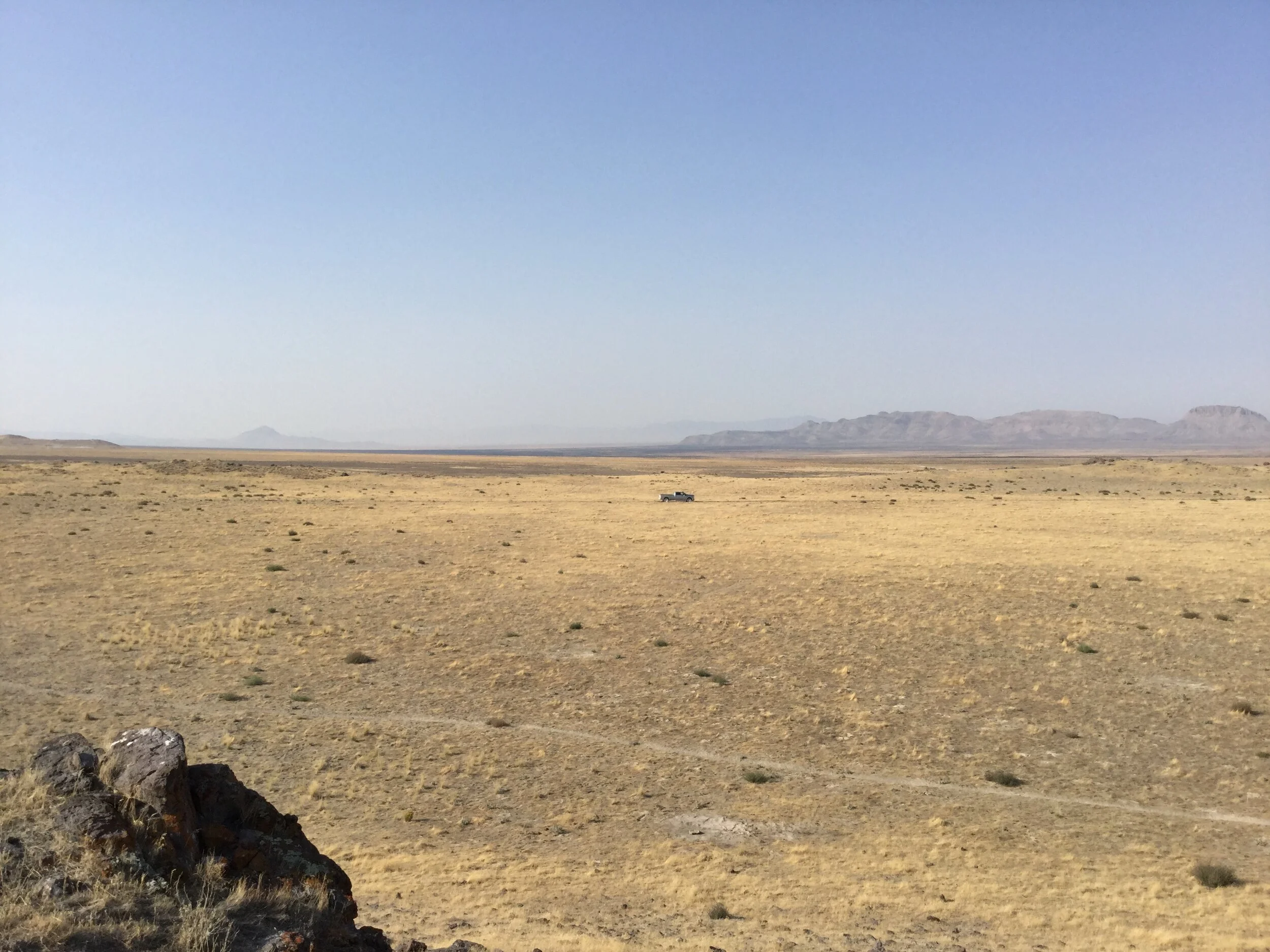
In late-September and early-October, three GSS staff members (Andy Nadeau, Peter McColl, and Matt Hogan) travelled to Utah for 12 days to complete a wetland mapping fieldwork trip. GSS staff complete fieldwork for almost all mapping projects the group takes on for the U.S. Fish and Wildlife Service National Wetlands Inventory (NWI) program. Current mapping efforts in Utah stretch across much of the western portion of the state and are spread across two projects.
These field trips are crucial for GSS analysts, as they allow researchers to verify whether the geologic features, soil types, and plant communities observed on aerial imagery is accurate with what is actually occurring on the ground. The lessons learned while in Utah will be documented and provided to all analysts and students working on the project at SMUMN, so that all features are mapped to a high level of accuracy.
Nadeau, McColl, and Hogan travelled over 2,500 miles by truck throughout the course of the trip, and visited over 250 checksites where they verified unique ground signatures and waterbodies. These checksites were typically located on Federal and State lands in areas of the state that are rarely visited by non-residents. Federal lands crossed included Zion National Park, the Sawtooth, Uinta, and Wasatch National Forests, and many National Conservation Areas. Highlights of the trip included routes through Zion National Park, various historic springs and seeps in the remote Utah mountains, salt flats and salt lakes, and rugged landscapes across many Wilderness and roadless areas of the state.


GeoSpatial Services Awarded New Projects
GSS was recently awarded new work from their partners/clients in multiple areas of the country.

New Alaska project areas are shown in yellow.
The Bureau of Land Management (BLM) wetlands mapping group of GSS recently bid on and won numerous projects in both Alaska and the Lower 48 states. The group will take on additional project work in Idaho and 5 new project areas in Alaska. This is in addition to the current mapping work going on in Colorado, Idaho, Wyoming, California, Idaho, New Mexico, Utah, and Alaska. The BLM group within GSS currently has 5 full-time staff members and 17 students engaged in landscape-level wetland mapping under the National Wetlands Inventory (NWI) managed by the US Fish and Wildlife Service (USFWS).

Counties in red are new areas where GSS will be mapping wetlands.
Another group within GSS, also working with the USFWS on NWI wetland mapping in North Dakota, has recently been awarded contracts to complete mapping across 14 additional counties in central North Dakota. The GSS North Dakota group will work towards the completion of this project over the next 18 months. After its completion, the GSS mapping teams will have completed mapping across most of the state. The North Dakota project engages 14 SMUMN students and 3 full-time GSS staff members.
GSS SPOTLIGHT!
Ted Sweet

What is your education and/or professional background?
I’m a senior at Saint Mary’s majoring in Math and Physics with an engineering emphasis. I started working for GSS in May 2019.
What led you to GIS? More specifically, how did you get to Saint Mary's University of Minnesota (SMUMN) in Winona?
I came to campus on a tour with my sister and decided this is where I wanted to go to school.
Explain briefly a project at GSS you've done that contributed to your overall knowledge and educational experience.
Currently I am working on a Bureau of Land Management (BLM) wetland mapping project in all of southern Wyoming, where I am learning all about connectivity.
How do you see GIS fitting into your future?
I am not sure how I see GIS fitting into my future but it is a distinct possibility.
Where can we find you outside of GSS?
Outside of GSS, you can find me on the track or in the weight room.